Access real-time sensor data with SXMCA
Developer edition for system integration
LiDAR, IMU, RTK, SLAM, Navigation data
$12,500.00

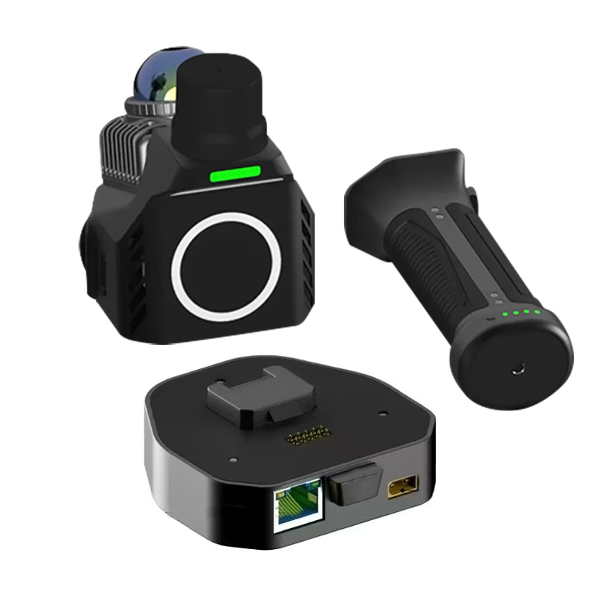
Access real-time sensor data with SXMCA
Developer edition for system integration
LiDAR, IMU, RTK, SLAM, Navigation data
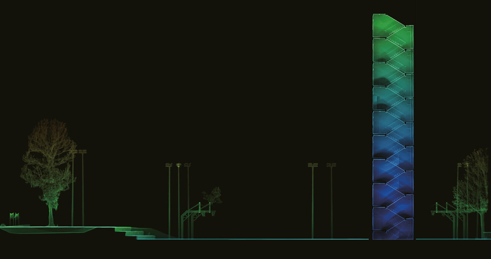
with professional-grade performance. Enhanced panoramic imaging, field-proven SOTA-SLAM algorithm, TimeSync 3.0 microsecond-level sensor synchronization, and 3DGS technology deliver centimeter-level accuracy and vivid spatial reconstruction, bringing effortless efficiency to every scenario. Next-Level Visualization Flagship panoramic cameras with 3DGS technology enable seamless view switching. One-click export to JPG, LAS, RCP, and PLY. AI-Powered SOTA-SLAM Trained on 2,000+ devices and 100 million m² of real-world data, AI-powered SOTA-SLAM (Spatial Omni-Temporal Adaptive) algorithm ensures robust
TimeSync 3.0
Smart Resume
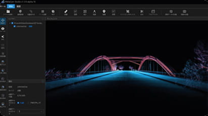
Real-Time Color
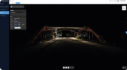
Point Cloud &
Scan Report
Panoramic
Measurement
3DGS
Reconstruc tion
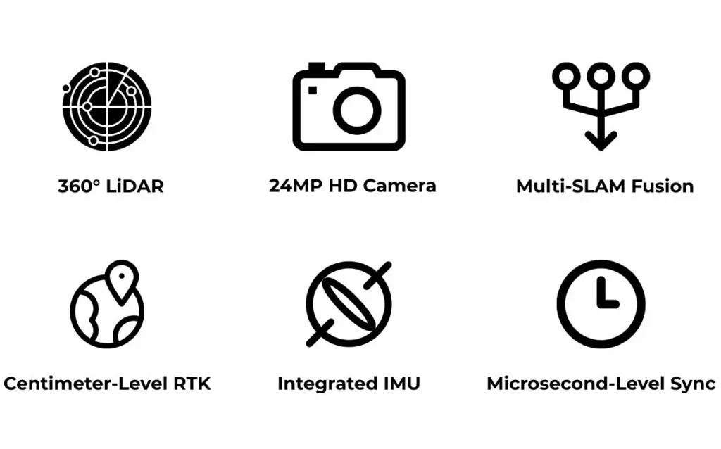
A built-in RTK module provides centimeter-level absolute accuracy.
360° LiDAR ensures complete coverage without blind spots.

Flagship panoramic cameras with 3DGS technology enable seamless view switching. One-click export to JPG, LAS, RCP, and PLY.
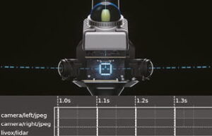
Hardware-level multi-sensor sync achieves microsecond alignment, ensuring native data consistency and precise, reliable fusion.
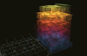
Trained on 2,000+ devices and 100 million m² of real-world data, AI-powered SOTA-SLAM (Spatial Omni-Temporal Adaptive) algorithm ensures robust mapping.
Two 12MP Sony cameras capture high-quality images to create colorized point clouds.
IP54 Protection for enabling outdoor scans and fieldwork
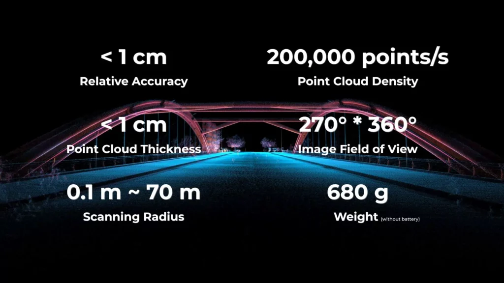
with a relative accuracy better than 1 cm


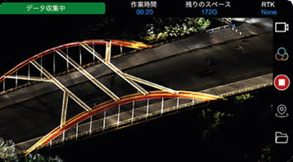
Real-time point cloud preview,quick quality
checks,anddevice status at a glance.
One-click point cloud processing with optimization, editing, and multi-format export. Seamlessly integrates with mainstream softwares.
Real-time point cloud and 3DGS computation with onlinepreview,supporting cloud collaboration and reducing local hardware dependency.
DATA RESULTS
High planarity of horizontal point clouds
Accurate vertical alignment