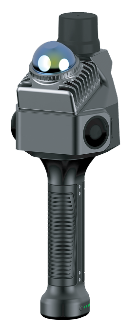
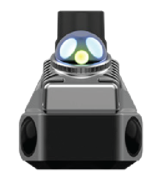
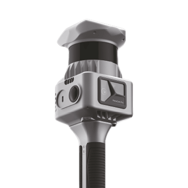
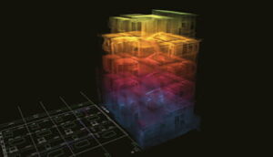
Experience a new standard for portable 3D scanning with the MetaCam Air. This compact, 680g device seamlessly integrates high-resolution RGB cameras, 360° LiDAR, and an RTK module. The result is instant, centimeter-accurate, and colorized point clouds. The MetaCam Air is engineered to deliver a unique combination of accuracy, mobility, and usability, making it the ideal solution for professionals in AEC, robotics, and digital twin applications who need powerful, on-the-go data capture.
With MetaCam Air, you’re not just scanning the world—you’re capturing the future of digital reality.
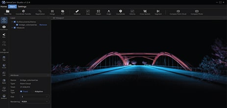
All-in-One Point Cloud Processing Tool
Data Optimization • Editing • Measurement
Direct Plug-in for Leading 3D Modeling Software
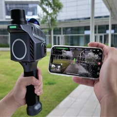
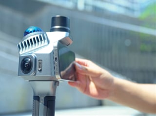
One-Tap Field Scanning
Live Cloud Visualization
Clear Device Monitoring

Weight
Dimensions
Wireless Connection
Operating Temperature
Protection Level
Power Supply Method
Power Supply Voltage
Battery Capacity
Power Consumption
Operating Time
Charging Method
Storage Capacity
Housing Material
RTK
RTK Accuracy
Solution Method
Point Cloud Format
Number of Laser Lines
Laser Class
Relative Accuracy
Absolute Accuracy
Point Cloud Thickness
Point Cloud Frequency
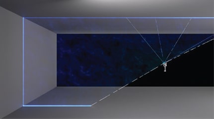
Scanning Radius
Laser Field of View
Point Cloud Density
Display Method
Image Quality
Image Field of View
680g (without battery), 1010g (with battery)
298 *105*104mm,133*105*104mm
Built-in Wi-Fi
-20℃~55℃
IP 54
Handle battery / External power supply
14.4V
3150 mAh
25W
≥100 Minutes
Type-C interface, PD fast charging
256GB (expandable)
Aerospace aluminum
Built-in integrated
Horizontal: 0.8 cm + 1 ppm
Vertical: 1.5 cm + 1 ppm
Real-time processing / Post-processing
.las / .ply / .rcp / .rcs
40 lines
Class1/905nm
Better than 1 cm
Less than 5 cm
Less than 1 cm
10Hz
0.1m – 40m @ 10% reflectivity
0.1m – 70m @ 80% reflectivity
59°*360°
200,000 points/s
Real-time colorized point cloud
2 *12MP, Sony 1/2.3 inch, F2.0
270°* 360°
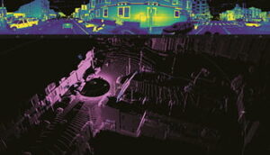
Ultra-light build with a leap in performance. Equipped with a powerful LiDAR system and SOTA-SLAM algorithm, it achieves maximum 5,200,000 pts/s high-speed capture and 5mm precision point cloud reconstruction. An innovative fixed-scan structure adapts seamlessly to both indoor and outdoor environments, fast or slow, delivering next-generation accuracy and efficiency for surveying and engineering professionals.
Maximum 5,200,000 pts/s
200 m Range
1263 g Ultra-light Design
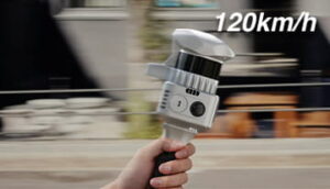
120 km/h High-speed Scanning Ready
Multiple Modes & Plug-ins
1 kg ultra-light body, maximum 5.2M pts/s capture, 5 mm accuracy. 40% lighter, 4× performance boost, built for any scenario.
Trained on 2,000+ devices and 100 million m² of real-world data, AI-powered SOTA-SLAM (Spatial Omni-Temporal Adaptive) algorithm ensures robust mapping.
Fixed-scan design replaces heavy rotating parts, reduces wrist load, and enables 360° capture. Supports high-speed mobile scanning for stable, efficient operation.
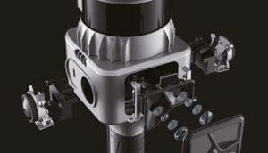
Combines panoramic, frontal high-res, and VSLAM vision system with 3DGS for true-color point clouds, detailed textures, and realistic 3D models in one capture.


CONTACT US / BUY
One of our experts will be communicating with you shortly. We are committed to understanding your application and providing support, tailored to your specific requirements.