
As cities grow and mobility demands increase, traffic planning is becoming more complex than ever. Traditional tools like cameras, induction loops, or manual counting methods often fall short when it comes to capturing the full picture of how vehicles and pedestrians actually move through urban spaces. This is where Lidar scanners are transforming the field.
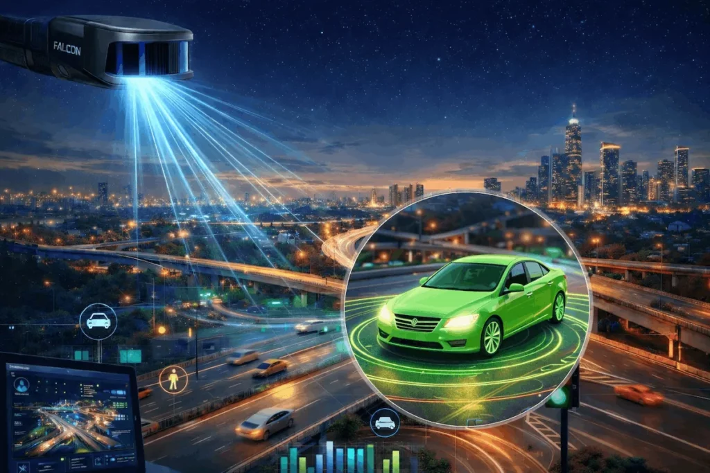
Lidar (Light Detection and Ranging) generates precise, real-time 3D maps by measuring the distance between emitted laser pulses and surrounding objects. For traffic planning teams, this means access to highly accurate data that goes far beyond simple counts or snapshots—it provides a full understanding of dynamic traffic behavior.
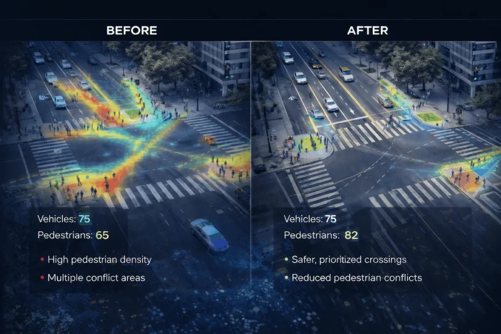
Unlike cameras, Lidar is not affected by lighting conditions. Whether it’s nighttime, foggy, or extremely bright: Vehicles can be detected with sub-meter precision Pedestrian flow can be tracked in complex environments Blind-spot areas become fully visible This enables planners to identify safety risks more reliably.
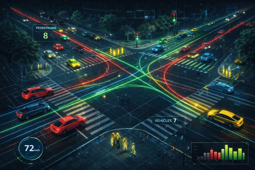
Intersections are the heart of urban traffic. With Lidar, planners can analyze:
This data supports optimized signal timings and more efficient intersection layouts.
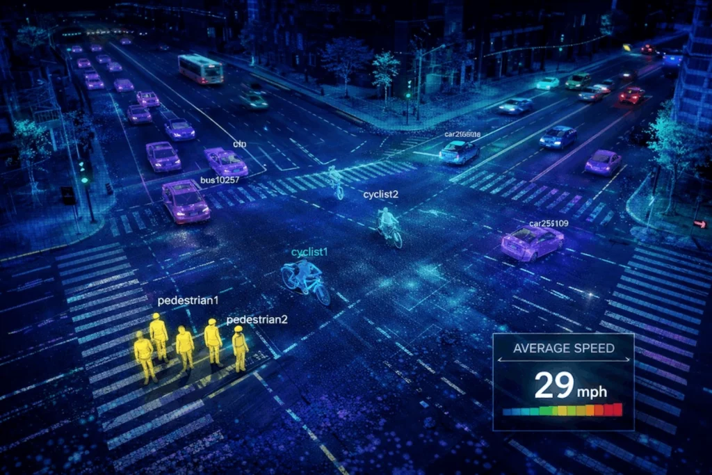
Modern Lidar scanners capture hundreds of thousands of points per second, creating a continuous, real-time view of traffic flow. This allows cities to: Monitor real time traffic density and congestion Detect dangerous driving behaviors Respond instantly to incidents or road closures The result is a more adaptive and resilient traffic management system.
Lidar is also invaluable beyond roadways. It supports:
With a full 3D profile of human and vehicle movement, planners can create safer, easier-to-navigate environments.
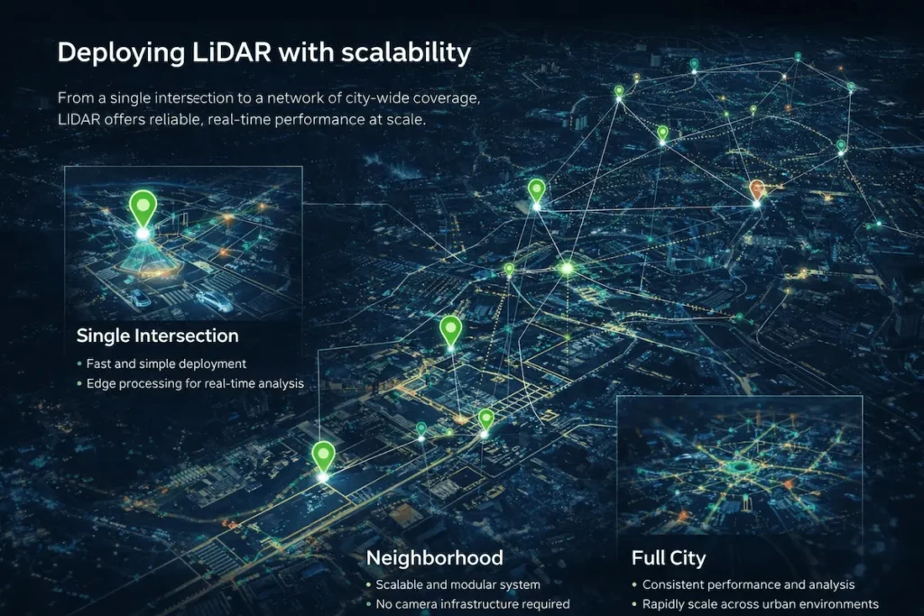
As smart city initiatives expand, Lidar is quickly becoming a core technology for modern traffic planning. It delivers the accuracy, reliability, and real-time insight needed to design safer intersections, reduce congestion, and build transportation systems that scale with growing urban populations.
Lidar scanners aren’t just enhancing traffic data, they’re enabling a completely new generation of planning tools that help cities move smarter.
We would be pleased to send you detailed information about our products or services.
Simply enter your details in the contact form below and we will get in touch with shortly.
CRATUS respects your personal information and keeps it safe. By sending this form, you consent to allow CRATUS to store and process your personal information as stated in our Privacy Policy.