

High precision

Weather resistance

Long distance

Large angle

Multi-platform support

Hybrid algorithm

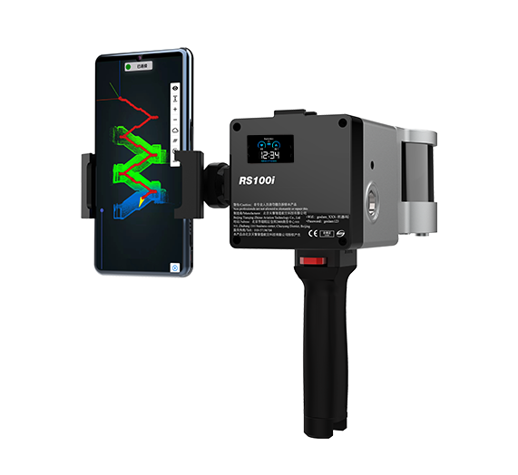
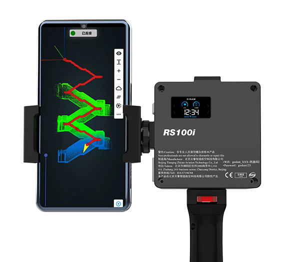
Real-time preview of APP

Single laser head
The GoSLAM RS100i mobile scanner supports a variety
of scanning modes and is suitable for a variety of
application scenarios. GNSS module can be switched
quickly, supporting scanning to obtain WGS84 and
CGCS2000 coordinate system point cloud, using the
second generation of mapping program, absolute
accuracy of about 2cm.
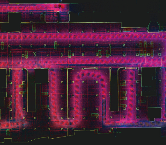
Multiple solutions ensure that the data is correct
High protection, multi-platform
Long distance, high frequency
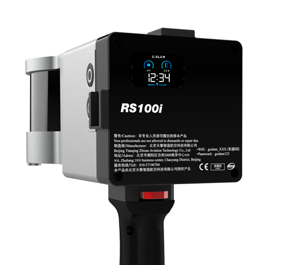
New color status display, larger size, support more status
information display, as well as the use of instructions,
easier to use and easier to use.
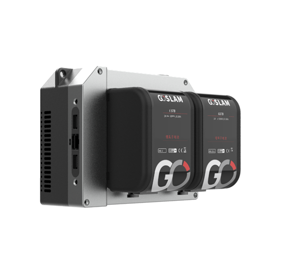
GoSLAM RS100i supports a variety of data transmission
modes, including mobile solid state drive, USB flash
drive, and wifi and Ethernet connection. The system has
an open interface and can realize collaboration with
third-party systems, which brings more possibilities for
expanding application scenarios and application modes.
Equipped with rotating laser side head, 120m range,
320,000 points per second, relative accuracy of 1cm; It
also supports various scanning modes and is equipped
with GNSS module, which is fast and flexible and suitable
for various application scenarios.
RS100i product has a unique Hybrid solving technology
of HSL (Hybrid solving), which can solve the data of the
last station in the scanning process, and the high-
precision data is faster and the efficiency is greatly
improved.
RS100i system has super weather resistance, can
operate in -35-60℃ environment, inherited excellent
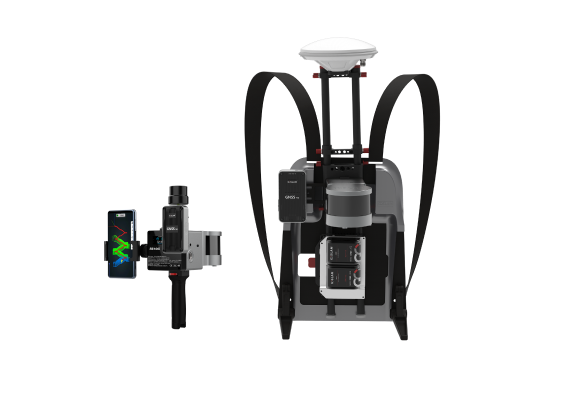
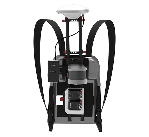
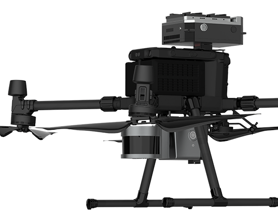
platform compatibility, support backpack, UAV, vehicle,
unmanned boat, robot dog and other platform scanning
mode, meet your mobile measurement of a variety of
imagination.
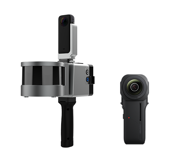
True color point cloud attached color, synchronous
generation of panoramic photos and videos, support
panoramic linkage function.
Mobile apps replace traditional touch screens. Browse
point cloud data in real time through APP during
operation. It supports a variety of browsing interaction
and more human-computer interaction content
GoSLAM Studio Flagship Version software is
specially designed and developed for the GoSLAM
series of mobile 3D scanners, integrating device
application and point cloud processing. It is also
compatible with third-party device point cloud
processing.
The software has eight basic functions: one-click point
cloud denoising, point cloud splicing, shadow rendering,
coordinate transformation, automatic horizontal plane
fitting, automatic point cloud data report generation,
forward photography and point cloud encapsulation.
GoSLAM adds one-click heap data generation to bulk
metering to make it easier to access data.
Scanning distance:
120m
Scanning speed:
0.32 million points/second
Point accuracy:
1cm (maximum)
Number of laser heads:
1
Solution:
Hybrid algorithm
Operation mode:
Physical button + Mobile APP
Working status:
LED status screen
Built-in SSD:
500GB expandable
Operating temperature:
-35°-60°C
Weight:
1.35KG (handheld)
Laser level:
Level 1 eye safety
Built-in SSD:
500GB expandable
Product shell:
Aviation grade aluminum (high protection, high anti-interference)
Scanning localization:
SLAM technology (no GPS required)
Working time:
4 hours
Multi-platform:
Hand-held, backpack, UAV, vehicle-borne safety kits
GET IN TOUCH
One of our experts will be communicating with you shortly. We are committed to understanding your application and providing support, tailored to your specific requirements.