

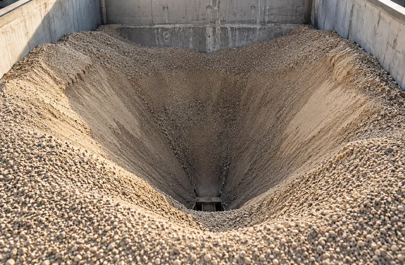
Craters over bottom feeders
Material drains from above each feeder first. A funnel forms while the material along the walls stays put, so a single level reading over the feeder, or beside it, is wrong in either direction.
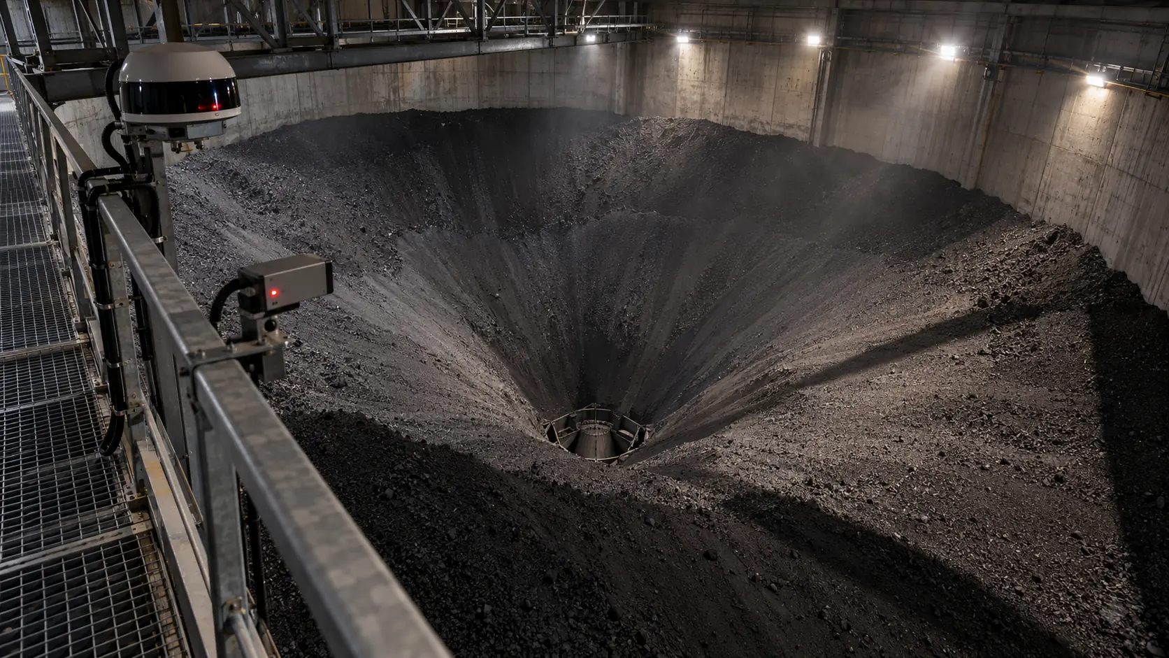
You can’t manage what you can’t measure
Bunkers fill on top and empty from below.
CRATUS measures material volume and weight in bunkers and bins with LiDAR, including the craters that bottom feeders draw into the material. Wide field-of-view LiDARs cover the overall surface and directional LiDARs look into craters, deep corners and steep walls, so the full surface is measured instead of a single level point.
The challenge
A bunker is rarely flat. How it is filled and how it is emptied decide the shape of the surface, and the shape decides whether a measurement is right.
Material drains from above each feeder first. A funnel forms while the material along the walls stays put, so a single level reading over the feeder, or beside it, is wrong in either direction.
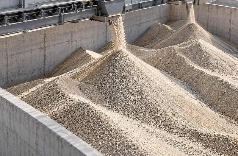
Material dropped from a conveyor or tripper builds cones and ridges at the drop points. Between them the surface is lower than it looks from the top.
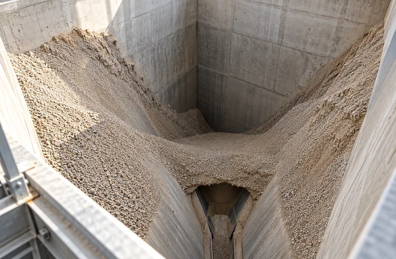
Hopper walls, deep bins and back corners sit at grazing angles from a single sensor. Material hangs up on walls and bridges over outlets.
CRATUS mixes wide-FOV and directional LiDARs to measure the whole surface, crater and corners included.
See the approachFill and reclaim strategies
Each pattern builds a different shape, and each shape needs a different view.
| Pattern | Surface it builds | How it is covered |
|---|---|---|
| Fixed drop point (conveyor or chute) | A cone under the drop point, lower toward the walls | Wide-FOV LiDAR over the cone and slopes |
| Moving tripper or shuttle | A row of cones or a ridge along the bunker | Wide-FOV LiDARs spaced along the ridge |
| Truck dump or loader push | Irregular heaps and push faces | Wide-FOV LiDARs, more overlap at the push face |
| Bottom feeders (single outlet) | A crater over the outlet, material held on the walls | Directional LiDAR into the crater, wide-FOV for the rest |
| Bottom feeders (multiple outlets) | Several craters with ridges between them | Directional LiDARs per crater zone, wide-FOV overall |
| Fill and reclaim at the same time | A cone and a crater changing together | Wide and directional LiDARs, scanned on a short schedule |
Typical patterns. Sensor types, count and positions for a specific bunker come from its coverage model.
Our approach
In a bunker the surface is rarely flat, so the approach is built around its shape: wide and directional LiDARs measure the whole surface, crater and corners included, and the edge computer merges them into one volume.
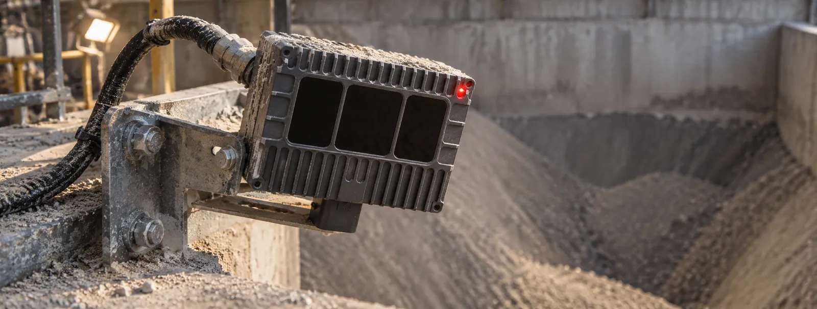
LiDAR sensing
Wide field-of-view LiDARs cover the overall surface and follow it as it rises and falls; directional LiDARs are aimed into the draw-down above bottom feeders and into deep corners a wide view sees poorly. Their own laser light means darkness, glare and uniform color do not matter.
Edge computing
One edge computer merges the wide and directional views into a single surface per bunker and computes the volume. Only results, not raw video, leave the site, over Ethernet, Wi-Fi or cellular; sites without easy IT access can start on cellular.
Software & dashboards
Volume and weight per bunker, with a history that shows filling, reclaiming and both at once, on a dashboard for operations and purchasing, with reports and exports for the systems you already run.
AI
AI separates the material surface from loaders, trucks, people and airborne dust, and can flag surface shape changes that do not match the volume being drawn, such as a hang-up or rat-hole, for a look.
What we deliver
Matched to how your bunker is filled, how it is emptied and how deep it is.
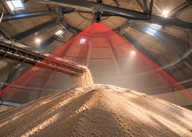
Covers the overall surface and follows it as it rises and falls, without re-aiming.
Sensing
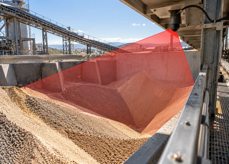
Aimed into the draw-down above bottom feeders and into deep corners a wide view sees poorly.
Sensing
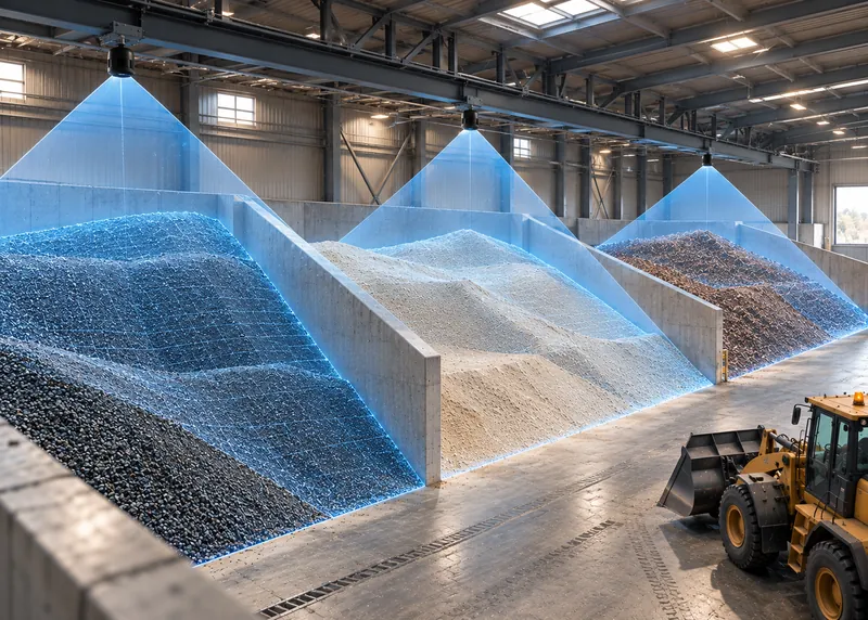
The combination of wide and directional LiDARs is chosen per bunker from its geometry and its fill and reclaim pattern.
Sensing · Edge
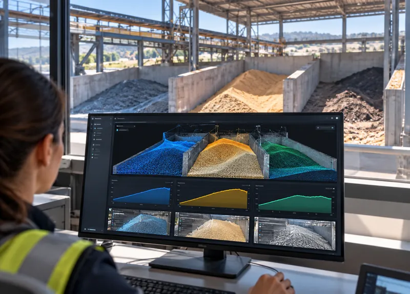
Volume over time shows filling, reclaiming and both at once, per bunker.
Software
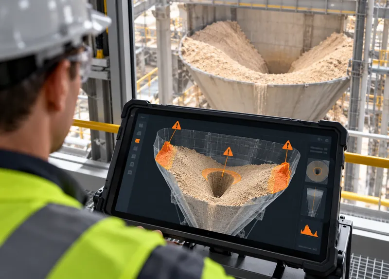
Surface shape changes that do not match the volume being drawn can be flagged for a look.
AI
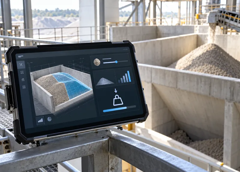
Weight from measured volume and the material’s bulk density.
Software
The CRATUS VMS system
Wide and directional LiDARs are combined per bunker; the edge computer merges them into one surface.
Overall surface coverage
Covers the overall surface of a bunker from one mounting point and follows it as it rises and falls, without re-aiming.
Targeted, longer reach
Aimed into the places a wide view sees poorly: the crater over a bottom feeder, deep corners and steep walls.
ASSET-Rx EDGE middleware
Runs at the site and merges the wide and directional views into one surface per bunker, so only the volume results leave the building.
Cloud or local
Volume, weight and fill and reclaim history per bunker. Choose a cloud subscription or a local license per unit, per site or company-wide.
For trusses, walls and ceilings
Holds each sensor at the angle chosen in the coverage model, on the structure above or beside the bunker.
For extremely dusty sites
For dusty bunkers with compressed air on site: keeps the sensor window clear between scheduled cleanings.
One system
CRATUS designs the coverage, supplies the sensors and edge computer, runs the software and supports the system after commissioning. One point of contact from site survey to the daily inventory number. Browse the VMS systems for bulk solids.
All CRATUS productsThese details let CRATUS build a coverage model for your structure.
How we work
Every bunker is different, so we start with a coverage model of its geometry and its fill and reclaim pattern. Sensor types, counts and positions are set before anything ships.
Its geometry and size, the material, how it is filled and reclaimed, plus power, connectivity and dust conditions.
CRATUS models the bunker, its fill and reclaim pattern and the material to choose wide and directional LiDAR types, counts and positions before anything ships.
Brackets, power and network, with instructions and remote support for your contractor or ours.
Reference scans, scan schedule and bulk density per material, checked against a known quantity where one is available.
Dashboard, reports and alerts per bunker, a lens-care schedule and engineering support for the life of the system.
Standards & practices
Bunkers often hold combustible dust, and the rules depend on the site. Area classification comes first; the installation is planned around it.
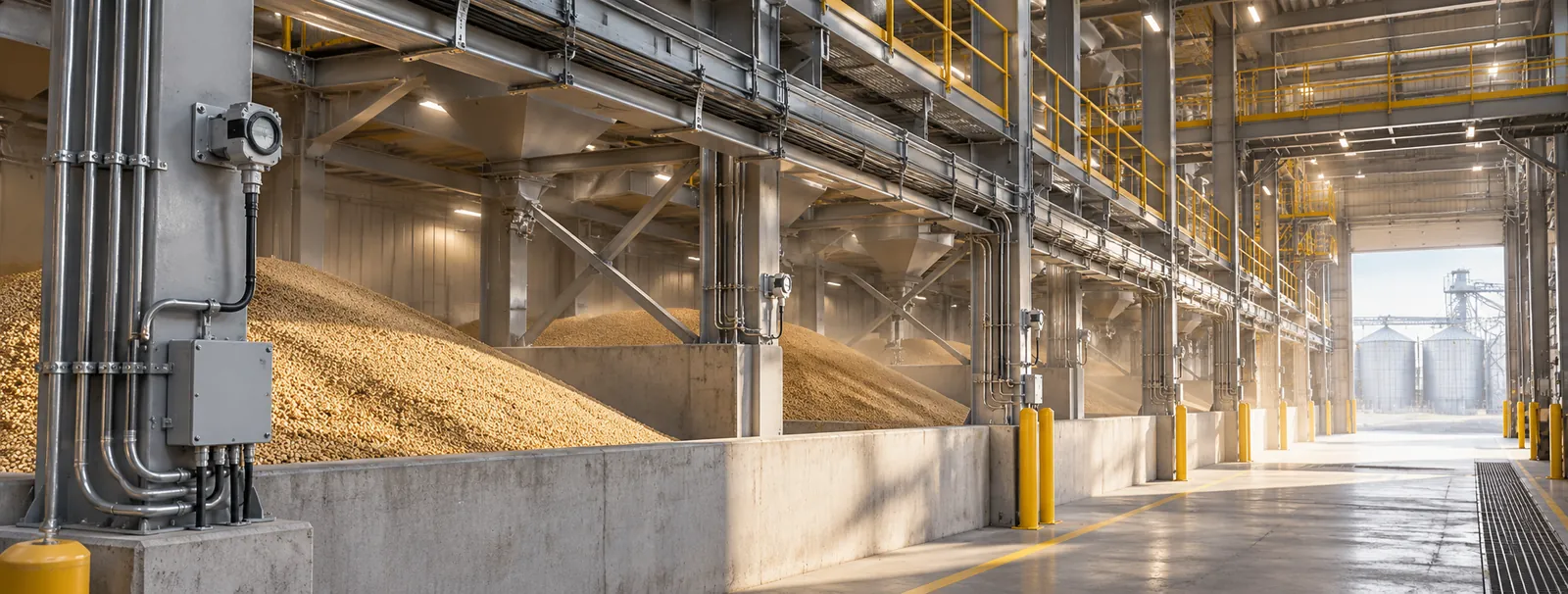
Area classification and compliance decisions rest with the site owner and the authority having jurisdiction. CRATUS plans the installation around these requirements and documents it to support your review; we don’t self-certify.
Because a bunker surface is not level. A radar or ultrasonic level sensor reads one point; with a crater over the feeder or a cone under the fill point, one point can be far from the average. LiDAR measures the whole surface.
Bottom reclaim. A bottom feeder draws material from directly above the outlet first, so a funnel forms while material along the walls moves later or not at all. The crater grows deeper as reclaim continues. Domes reclaimed from a tunnel show the same pattern: see Volume Measurement for Materials in Storage Domes.
Each covers what the other does poorly. A wide-FOV LiDAR sees most of the surface from one position; a directional LiDAR reaches into a crater or deep corner at a better angle. Together they cover the whole surface.
Yes. Measurement continues during filling and reclaim; the surface model updates with each scan, and the history shows both flows.
Yes. A fixed drop point, a moving tripper and truck or loader filling each build a different surface, and the coverage model accounts for it when choosing sensor types and positions.
It can flag it for a look. When the surface shape stops matching the material being drawn, or a crater stops growing while the feeder runs, the change is visible and can trigger an alert.
120 VAC near the edge computer, 12 VDC for the sensors and a network connection. Where 12 VDC, an enclosure or internet access are not available, CRATUS can supply the power supply, enclosure and a cellular modem.
A scheduled cleaning of the sensor window is standard on dusty sites, and AI filtering keeps airborne dust out of the measurement. Where dust is extreme and compressed air is available, an air purge collar keeps the window clear between cleanings.
Yes, with the right planning. Area classification comes first, then the installation is planned around it, including where equipment is placed and when it is energized. CRATUS documents the installation for the site owner and the authority having jurisdiction.
The bunker type and size, the material, and how it is filled and reclaimed. CRATUS builds a coverage model, replies with a proposal that shows the sensor layout and expected performance, and follows with a quote with options.
Both cloud and local options: a cloud dashboard subscription, a local dashboard license per unit, a site license for several units, or a company license.
Yes. CRATUS works with plant teams, system integrators and IT departments, and provides installation instructions, network requirements and remote support during commissioning.
Talk to a CRATUS engineer
Send us the bunker dimensions, the fill method and the number and position of feeders. A CRATUS engineer will reply with a wide and directional LiDAR layout.
Keep exploring
Illustrations are not to scale. Specifications subject to change without notice.
GET IN TOUCH
One of our experts will be communicating with you shortly. We are committed to understanding your application and providing support, tailored to your specific requirements.