Mobile Mapping LiDAR Systems

Portable LiDAR Scanners for AEC and Survey

Direct 3D Point Cloud Acquisition for BIM and As-Built Documentation

The CRATUS SXMCA Series pairs 905 nm and 865 nm LiDAR with hardware-synchronized fisheye cameras, SOTA-SLAM and RTK georeferencing (SXMCA2 and SXMCA Pro). Capture 3D point clouds in motion with relative accuracy from 5 mm to under 1 cm across structural, civil, and architectural survey sites.

  • SXMCA Hardware Parameters:
  • Up to 5.24M pts/s (Pro)
  • 5 mm relative accuracy (Pro)
  • TimeSync 3.0 Hardware Lock
  • RTK GNSS (SXMCA2, Pro) · PPK (Pro)
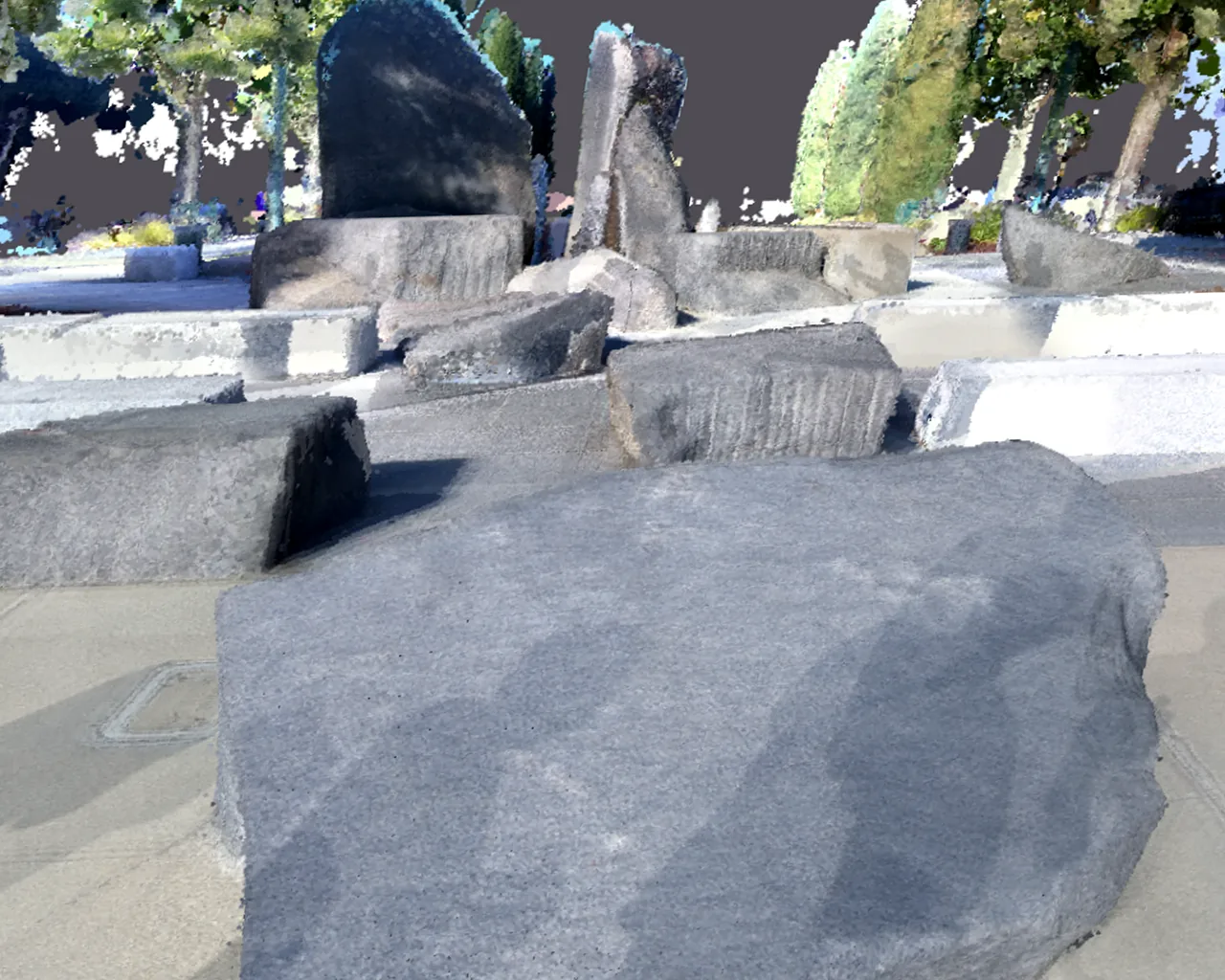
Colorized SXMCA point cloud of granite boulders on a plaza, registered to the photograph
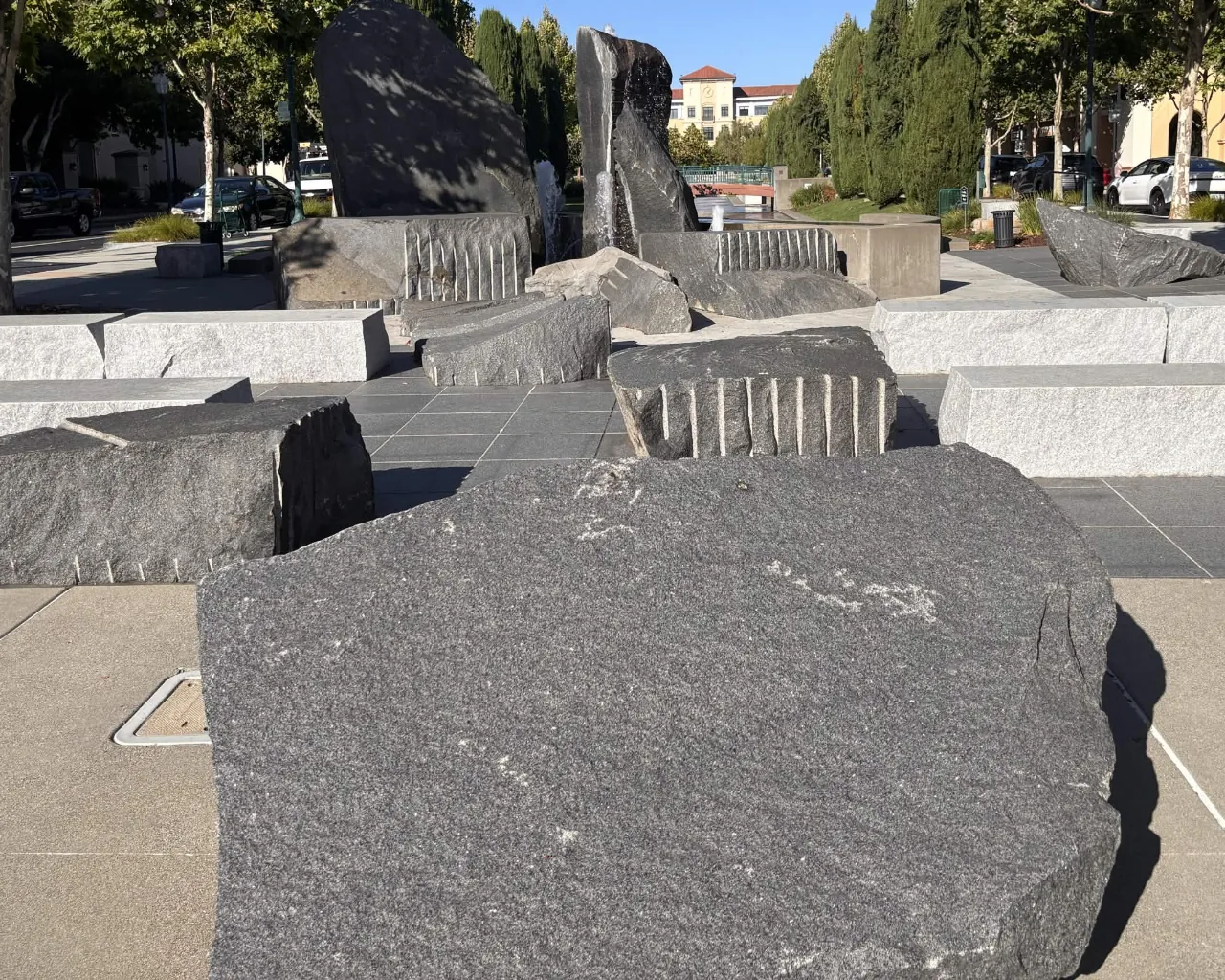
Photograph of the same granite boulders and plaza taken on site as the optical reference
Optical Reference (Photo)Photo SXMCA LiDAR Point CloudPoint cloud
← Drag to compare photo and point cloud →
Hardware SynchronizationTimeSync 3.0 (microsecond-level)
Relative Accuracy5 mm (Pro) to < 1 cm
  • 5.24M pts/sSXMCA Pro maximum point rate (2.62M pts/s typical)
  • 5 mm AccuracySXMCA Pro relative accuracy and point cloud thickness
  • 982 g – 1,325 gTotal mass across models (Pro with RTK)
  • Up to 200 mSXMCA Pro range (170 m @ 80% reflectivity)

Hardware Lineup

Sensor models for interior, civil, and mobile survey operations.

Three hardware configurations engineered for architectural as-built documentation, georeferenced land surveys, and high-speed mobile platform integration up to 120 km/h. Compare every handheld option on the handheld LiDAR scanners page, or browse the CRATUS AEC and mapping and survey systems.

SXMCA Lite

SXMCA Lite

Interior Spatial Measurement Scanner

  • 216,000 pts/sec
  • 8 mm Relative Accuracy
  • 70 m Range
  • 1,123 g With Battery

Optimized for near-field architectural surveys, floor-plan verification, and BIM modeling. A non-repetitive LiDAR with a smaller laser spot reduces corner noise and point distortion at short-to-mid range.

Camera: 2x Fisheye (12 MP output)
Battery: 150 min runtime
Storage: TF card, 128 GB incl.
Protection: IP5X (-20 °C to +55 °C)
View SXMCA Lite
SXMCA2

SXMCA2

Compact Mobile Mapping System with RTK

  • 200,000 pts/sec
  • 982 g Total Mass
  • Dual Fisheye (12 MP output)
  • Multi-Band RTK GNSS

Engineered for lightweight field surveys requiring direct georeferenced coordinates. Features integrated RTK positioning (0.8 cm + 1 ppm horizontal), raw GNSS observation logging, and dual fisheye cameras for colorized point clouds and 3DGS.

Camera: 2x Fisheye (12 MP output)
Battery: 150 min runtime
Accuracy: < 1 cm rel. / 5 cm abs.
Constellations: GPS, GLONASS, Galileo, BDS, QZSS, NavIC, SBAS
View SXMCA2
SXMCA Pro

SXMCA Pro

High-Density Multi-Platform LiDAR Scanner

  • 5.24M pts/sec Maximum
  • 5 mm Processed Accuracy
  • 200 m Maximum Range
  • 120 km/h Scanning

Non-rotating LiDAR with visual-LiDAR fusion SLAM for lower vibration and stable capture at mobile speed. Supports vehicle-mounted scanning up to 120 km/h and a backpack kit, with RTK, PPK and GCP global optimization.

Sensors: 4 Cameras + 1 LiDAR
Storage: 1 TB SSD
Platforms: Handheld, Backpack, Vehicle
Export: .las, .pcd, .ply, .rcp, .e57
View SXMCA Pro

Engineering Specifications

Datasheet comparison of SXMCA sensor models.

Values from the manufacturer datasheets. Accuracy is measured under laboratory conditions and actual performance may vary. Fisheye and HD cameras output 12 MP by default; the 48 MP sensor resolution is available on request.

Specification Parameter SXMCA Lite SXMCA2 SXMCA Pro
Point Cloud Capture Rate 216,000 pts/sec 200,000 pts/sec 2,620,000 typical (up to 5,240,000 pts/sec)
Processed Accuracy 8 mm relative (5 cm absolute) < 1 cm relative (5 cm absolute) 5 mm relative & thickness (< 3 cm absolute)
Measurement Range 0.05 – 40 m @ 10% / up to 70 m @ 80% 0.1 – 40 m @ 10% / up to 70 m @ 80% 0.5 – 90 m @ 10% / up to 170 m @ 80%
LiDAR Channels & Wavelength 1 unit, Class 1 / 905 nm 1 unit, Class 1 / 905 nm 1 unit (non-rotating), Class 1 / 865 nm
LiDAR Field of View 360° x 65° 360° x 59° 360° x 42.4°
Camera Configuration 2x fisheye, 200° x 200° (48 MP sensor, 12 MP output) 2x fisheye, 200° x 200° (48 MP sensor, 12 MP output) 4 cameras: 2x panoramic fisheye + HD + V-SLAM (48 MP sensors, 12 MP output)
Positioning & GNSS SOTA-SLAM (supports GCPs) RTK-SLAM (0.8 cm + 1 ppm H / 1.5 cm + 1 ppm V), raw observation logging RTK + PPK + GCP optimization (GPS, GLONASS, BDS, Galileo, QZSS, NavIC, SBAS)
Total Enclosure Mass 1,123 g (760 g main unit) 982 g (619 g main unit) 1,160 g (1,325 g with RTK)
Operating Time & Power 150 min (45.36 Wh, PD 30W) 150 min (45.36 Wh, PD 30W) 60 min (45.36 Wh, PD 30W)
Data Storage TF card, 128 GB included (up to 1 TB) TF card, 256 GB included (up to 1 TB) 1 TB built-in SSD
Protection & Operating Temperature IP5X, -20 °C to +55 °C IP5X, -20 °C to +55 °C IP5X, -20 °C to +55 °C
Mounting Options Handheld; optional Hub accessory Handheld; optional Hub accessory Handheld, backpack kit, vehicle-mounted (120 km/h), Hub
Export File Formats LAS, PCD, PLY, RCP, E57; 3DGS (PLY); mesh (OBJ); JPEG LAS, PCD, PLY, RCP, E57; 3DGS (PLY); mesh (OBJ); JPEG LAS, PCD, PLY, RCP, E57; 3DGS (PLY); mesh (OBJ); JPEG

Data Acquisition Pipeline

Data capture, synchronization, reconstruction, and export.

Hardware sensor synchrony and algorithms replace legacy terrestrial survey station setups.

Mobile Kinematic Scanning

Operators traverse survey trajectories at normal walking velocity without stationary tripod setups or physical target spheres. The operator interface displays real-time point cloud feedback with live colorization.

  • Zero static station stops: Continuous walking survey velocity
  • Resume scan feature restores registration across multi-room passes
  • Vehicle-mounted scanning up to 120 km/h (SXMCA Pro)

Hardware Sensor Synchronization

TimeSync 3.0 provides hardware-level, microsecond-level alignment across all sensors, ensuring data consistency and reliable fusion.

  • Cleaner raw data for third-party processing and development
  • Visual-LiDAR fusion SLAM keeps positioning stable throughout the scan (SXMCA Pro)
  • RTK, PPK and GCP fusion with SLAM corrects drift and anchors each scan to real-world coordinates (SXMCA Pro)

3D Gaussian Splatting Reconstruction

3D Gaussian Splatting (3DGS) generates continuous volumetric radiance fields directly from synced LiDAR point clouds and high-resolution panoramic frames for spatial digital twins.

  • 3DGS models are generated on the cloud platform and exported as PLY
  • Volumetric representation for virtual walkthroughs and simulations
  • Accurate surface radiometric rendering across complex facade geometries

Standardized File Interoperability

Data outputs export directly into industry-standard point cloud formats, so scans load into mainstream point cloud and BIM software.

  • Point clouds: LAS, PCD, PLY, RCP and E57; mesh as OBJ; 3DGS as PLY
  • Dual-band Wi-Fi 6 and Bluetooth; TF card storage (SXMCA Lite, SXMCA2) or 1 TB SSD with USB 3.0 Type-C export (SXMCA Pro)
  • SXMCA GO (iOS/Android), SXMCA STUDIO (Windows) and SXMCA CLOUD (web) for preview, processing and collaboration

Hardware & Mechanics

What are the physical dimensions and weight of each scanner?

The SXMCA2 weighs 982 g (363 g battery, 619 g main unit). The SXMCA Lite weighs 760 g for the main unit and 1,123 g with the battery. The SXMCA Pro weighs 1,160 g, or 1,325 g with the RTK module. All three are rated IP5X with an operating temperature of -20°C to +55°C.

How are vehicle and backpack mounting supported?

The SXMCA Pro uses a non-rotating LiDAR and supports vehicle-mounted scanning up to 120 km/h and a backpack kit, with RTK, PPK and GCP optimization. An optional Hub accessory adds stationary or drone-mounted integration.

Survey Accuracy & Georeferencing

What is the measurable accuracy of the processed point cloud?

SXMCA Lite reaches 8 mm relative accuracy and 8 mm point cloud thickness, with 5 cm absolute accuracy. SXMCA2 reaches under 1 cm relative accuracy and thickness, with 5 cm absolute accuracy. SXMCA Pro reaches 5 mm relative accuracy and thickness, with under 3 cm absolute accuracy. RTK on the SXMCA2 and SXMCA Pro adds 0.8 cm + 1 ppm horizontal and 1.5 cm + 1 ppm vertical positioning. Values are measured under laboratory conditions; actual performance may vary.

Are physical control points (GCPs) required for scan alignment?

No external targets or spheres are necessary for SLAM registration. In certified boundary or high-order engineering surveys, ground control points can be imported into post-processing software to cross-validate geodetic alignment.

Data Pipelines & Interoperability

Which software formats are exported for BIM and CAD programs?

All three SXMCA scanners export point clouds as LAS, PCD, PLY, RCP and E57, 3DGS models as PLY, meshes as OBJ and images as JPEG.

How does 3D Gaussian Splatting (3DGS) integrate into deliverables?

3DGS uses calibrated camera exposures and synchronized point cloud geometry to train volumetric Gaussian scenes. Models are generated on the cloud platform and exported as PLY for photorealistic visual simulation and AEC inspection workflows.

Technical Engagement

Specify your mobile LiDAR survey deployment.

Request technical datasheets, evaluate raw .LAS sample point clouds, or schedule an engineering consultation for AEC and survey integration.

GET IN TOUCH

One of our experts will be communicating with you shortly. We are committed to understanding your application and providing support, tailored to your specific requirements.