How do you measure stockpile volume?
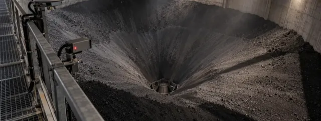
Volumetric stockpile measurement with LiDAR starts with a 3D scan of the pile surface, captured as a 3D point cloud. The system reconstructs the real geometry of the pile and calculates volume directly from that model. Multi-angle LiDAR fusion handles irregular shapes, peaks and valleys, and the measurement works in dust, rain, darkness and full sun. Volume then converts to weight using a density model calibrated for your material.
What is stockpile inventory monitoring?
Stockpile inventory monitoring means knowing how much material is in each pile without manual surveys. Fixed 3D LiDAR scans the pile continuously and each site processes the data locally on its own edge unit. Real-time volume data can feed inventory reporting, planning and audit support, and aggregated views and cross-site reconciliation flow through the central dashboard or get pushed to your ERP, MES, historian, or BI tools.
How does LiDAR stockpile measurement compare with drone and manual stockpile surveys?
In the comparison above, manual surveys and drone flyovers are not continuous and do not work in dust, rain or darkness. Drone methods also use a static density for weight and rely on a vendor cloud. CRATUS LiDAR measures continuously, works indoors and outdoors, processes data fully on the edge, and uses a characterized density with environmental compensation for weight estimation.
Which materials can CRATUS LiDAR measure in a stockpile?
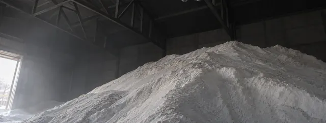
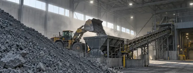
CRATUS LiDAR tracks aggregates, crushed stone, sand, gravel, ores, coal, road salt, biomass, woodchips, powders, scrap metal, fertilizer and other bulk solids across open or semi-enclosed storage areas. The density model is calibrated for your material, so the same system reports volume and estimated weight.
Can LiDAR monitor stockpiles continuously, outdoors and indoors?
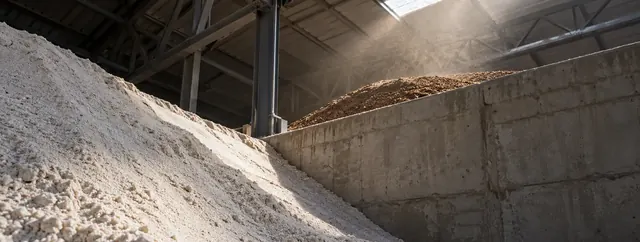
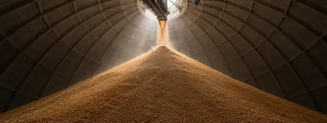
Yes. Fixed 3D LiDAR continuously maps outdoor stockpiles of aggregate, ore, coal and other bulk materials, and 3D LiDAR continuously scans material stored inside domes, bunkers and indoor warehouses. Contactless measurement also keeps operators away from unsafe inspection areas, moving equipment and unstable stockpiles.
What is LiDAR volume measurement?
LiDAR volume measurement uses 3D Light Detection and Ranging sensors to scan the surface of bulk material (a stockpile, a silo, a truck bed, or material on a conveyor) and build a high-resolution geometric model from which volume is calculated directly. CRATUS combines LiDAR volume measurement with lab-characterized material density to deliver weight estimation with a documented confidence interval.
How accurate is LiDAR volume measurement?
CRATUS LiDAR Volume Measurement Systems routinely achieve 99%+ volumetric measurement accuracy in properly engineered and calibrated installations. In our most recent validated installation, the system achieved 99.7% measurement accuracy. Actual performance depends on installation geometry, LiDAR coverage, material characteristics, environmental conditions, and the quality of the reference calibration. Multi-angle LiDAR fusion, up to four sensors per edge unit, eliminates blind spots on irregular pile shapes. Weight estimation accuracy additionally depends on how thoroughly the material has been characterized in our lab and how variable site conditions are, and every weight number ships with a confidence interval so you know how much to trust it.
Why use LiDAR for weight estimation instead of a scale?
Scales, such as belt scales and weighbridges, measure weight directly but only at one point in the workflow. They often require trucks to stop, drift over time, and need calibration shutdowns. LiDAR-based weight estimation works continuously, anywhere material exists (in piles, on belts, in silos, on moving trucks), without contact, without stopping, and without recalibration outages. CRATUS LiDAR weight estimation pairs the geometric measurement with a material density model that accounts for humidity, temperature, pile shape, and seasonal variation.
Does LiDAR work outdoors? In dust and rain?
Yes to all three. LiDAR is an active sensor that emits its own light, so darkness is irrelevant. The right LiDAR sensor selection handles dust, rain, snow, and full sun. Outdoor CRATUS LiDAR installations are routine across mining, quarrying, ports, and agriculture deployments.
Can LiDAR replace my weighbridge or belt scale?
Often, yes. Most customers run CRATUS LiDAR alongside existing scales during commissioning to validate the system, then either replace the scale, keep both for cross-validation, or use LiDAR to flag drift and maintenance issues on the legacy equipment. You decide the path during the feasibility step.
How long does a LiDAR deployment take?
A single-use-case LiDAR pilot at one site typically runs four to eight weeks from site assessment to live data. Multi-site LiDAR rollouts scale from there. The CRATUS engagement process covers feasibility, layout design, pilot, integration, and ongoing operations.
Can CRATUS LiDAR handle multiple sites on one dashboard?
Yes. Each site processes LiDAR data locally on its own edge unit. Aggregated views and cross-site reconciliation flow through the central dashboard or get pushed to your ERP, MES, historian, or BI tools.
What does a CRATUS LiDAR deployment cost?
One-time hardware purchase, including LiDAR sensors and edge units, plus your choice. Run it yourself with one-time engineering fees for service work like sensor swaps, recalibration, or new material characterization. Or subscribe for managed operations: per-node monthly fee covering remote LiDAR monitoring, software updates, multi-site rollup, multi-user access, and ongoing support. Fixed-price quote after the feasibility study.