
Choose a handheld SLAM LiDAR scanner when speed and coverage matter more than millimeter precision. That covers building interiors, as-built updates and progress capture. Choose a terrestrial (tripod) laser scanner when the job needs millimeter-level accuracy over longer distances, such as survey control, monitoring or fabrication. Some teams own both: terrestrial for control, handheld for fast coverage.
This guide compares a handheld LiDAR scanner vs a terrestrial laser scanner on accuracy, speed and fit, so you can pick the right tool for the job. If you already know you need a handheld, see our handheld LiDAR scanners with full specifications.
Handheld LiDAR Scanner vs Terrestrial Laser Scanner at a Glance
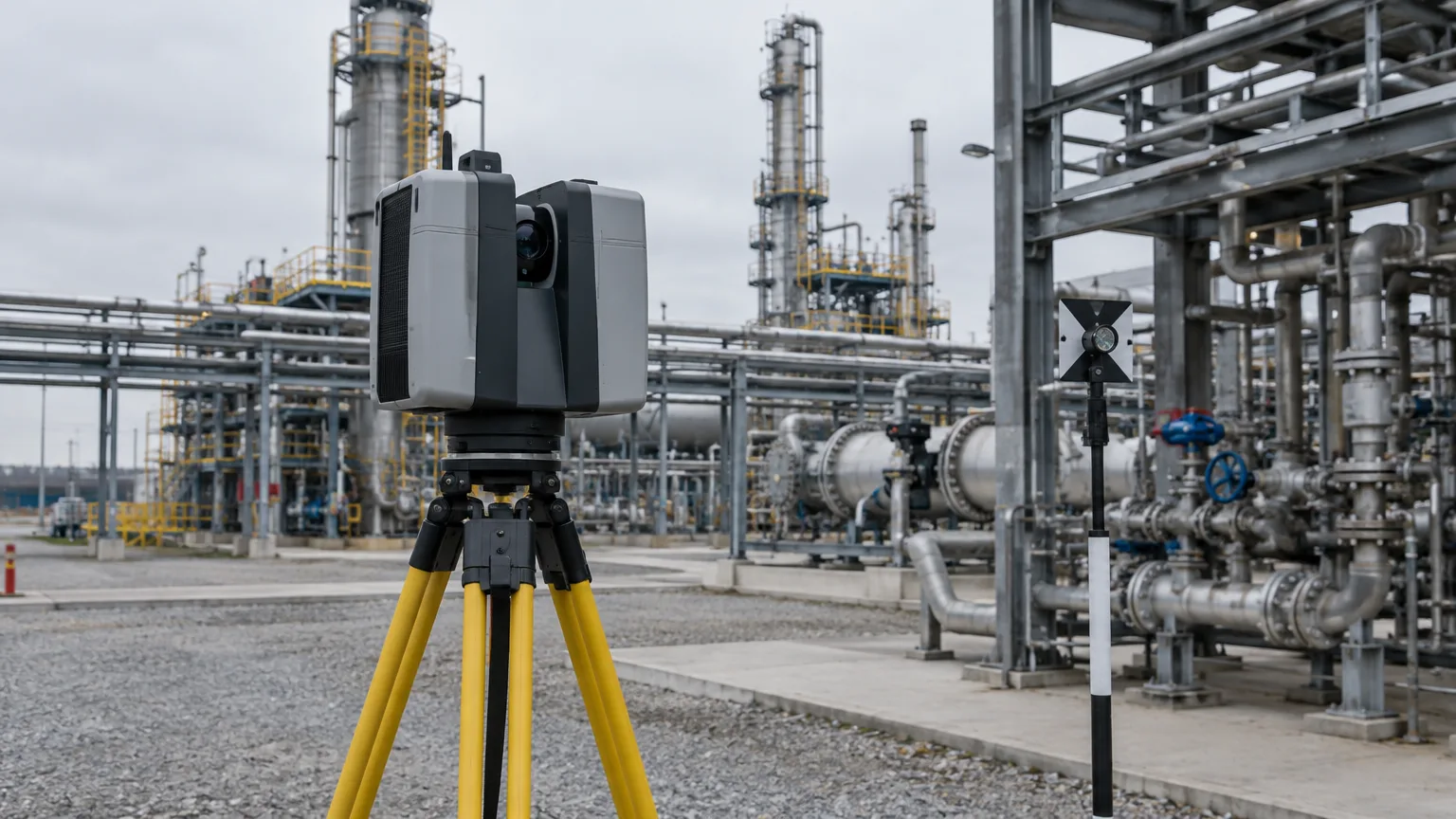
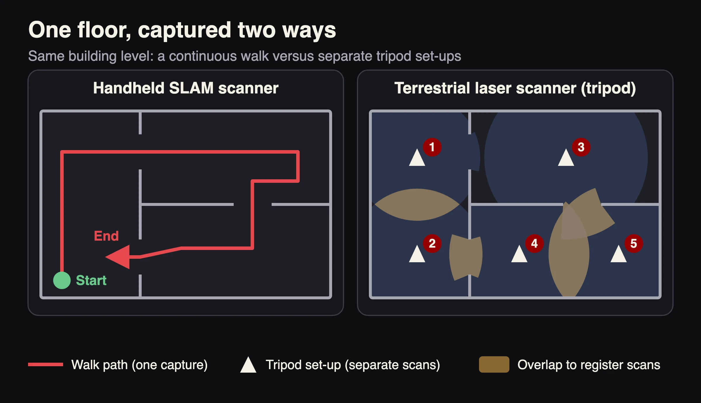
A handheld SLAM scanner is a portable LiDAR device. You walk through a site, and SLAM software (simultaneous localization and mapping) joins the scans as you move. A terrestrial laser scanner sits on a tripod. It scans from fixed positions, and the scans are registered into one point cloud afterward.
| Handheld SLAM scanner | Terrestrial (tripod) scanner | |
|---|---|---|
| How it captures | You walk. The scan is joined as you move. | Fixed set-ups on a tripod. Scans are registered afterward. |
| Typical accuracy | Centimeter class. For the SXMCA2, the CRATUS handheld scanners page lists relative accuracy better than 1 cm and absolute accuracy under 5 cm. | Millimeter class. Published datasheets of survey-grade tripod scanners list a 3D point accuracy of about 2 mm at 10 m. |
| Range | SXMCA Lite and SXMCA2: 0.1 to 40 m at 10% reflectivity, up to 70 m at 80%. SXMCA PRO: up to 200 m. | Depends on the model. Check the datasheet, and the accuracy at your working distance. |
| Capture speed | Continuous. You capture while you walk. | Fast per set-up, since some models are advertised with a color scan in under 2 minutes, but a building needs many set-ups. |
| Tight or cluttered spaces | Strong. It reaches where a tripod does not fit. | Limited by tripod placement and line of sight. |
| Skill needed | Lower. Geo Week News cites minimal training. | Higher. Planning set-ups and registration. |
| Best for | Interiors, as-builts, progress capture, layout, mapping. | Survey control, facades, plant detail, monitoring. |
How Accurate Is Each One?
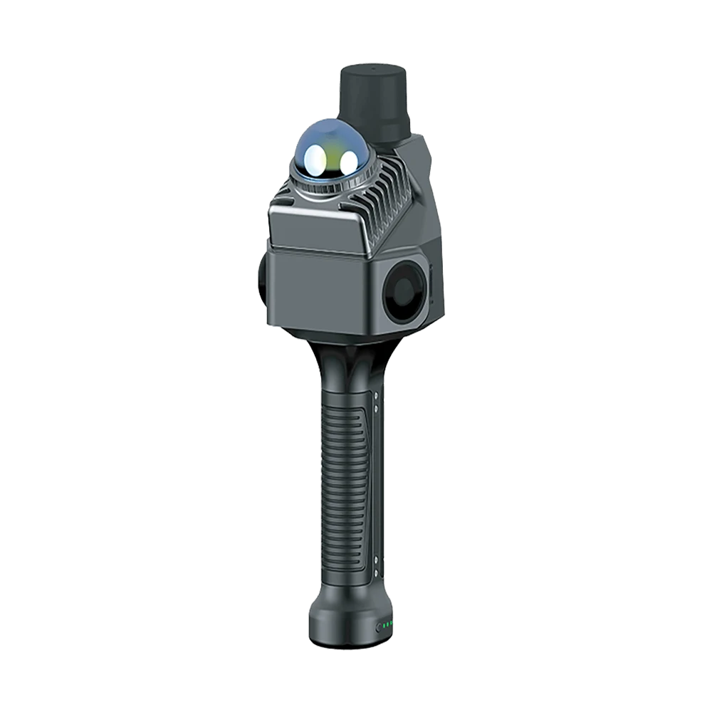
Terrestrial laser scanners are the accuracy reference. The published datasheets we checked for survey-grade tripod scanners list a 3D point accuracy of about 2 mm at 10 m, roughly 3 mm at 20 to 25 m and about 5 mm at 40 m. Check how a datasheet defines its figure, for example as a standard deviation under stated conditions, before you compare two scanners.
Handheld SLAM scanners are typically specified in the centimeter class, which means roughly 1 cm of relative accuracy and a few centimeters of absolute accuracy. For the SXMCA Lite, CRATUS lists relative accuracy under 1 cm. For the SXMCA2, CRATUS lists relative accuracy better than 1 cm and absolute accuracy under 5 cm. The SXMCA PRO is listed at about 5 mm point cloud precision. Precision describes how closely repeated measurements agree, not how close they are to the true position, so do not compare it directly with the 3D point accuracy of a tripod scanner.
Relative accuracy and absolute accuracy are not the same
Relative accuracy tells you how well a scan keeps its shape, for example the distance between two walls. Absolute accuracy tells you how well the whole scan sits in real-world coordinates. SLAM can drift over a long walk, so absolute accuracy depends on how you close loops, on control points and, outdoors, on RTK (real-time kinematic) satellite positioning. The SXMCA2 and SXMCA PRO have RTK built in. The SXMCA2 page lists RTK accuracy of 0.8 cm + 1 ppm horizontal and 1.5 cm + 1 ppm vertical. The 1 ppm (parts per million) term adds about 1 mm of error for every kilometer from the base station.
What that means for your job
| Job | Tolerance usually needed | Better fit |
|---|---|---|
| Renovation planning, space planning, as-built updates | Centimeter | Handheld SLAM |
| Construction progress capture and model comparison | Centimeter (check your specification) | Handheld SLAM |
| Facility layout and digital twins | Centimeter | Handheld SLAM |
| Survey control, boundary and topographic work | Millimeter to centimeter, with a defined coordinate system | Terrestrial scanner or RTK survey, with handheld for fill |
| Deformation monitoring, steel or machinery fit-up | Millimeter | Terrestrial scanner |
These are guidelines, not standards. Use the tolerance written in your contract or specification.
How Much Faster Is Handheld Scanning?
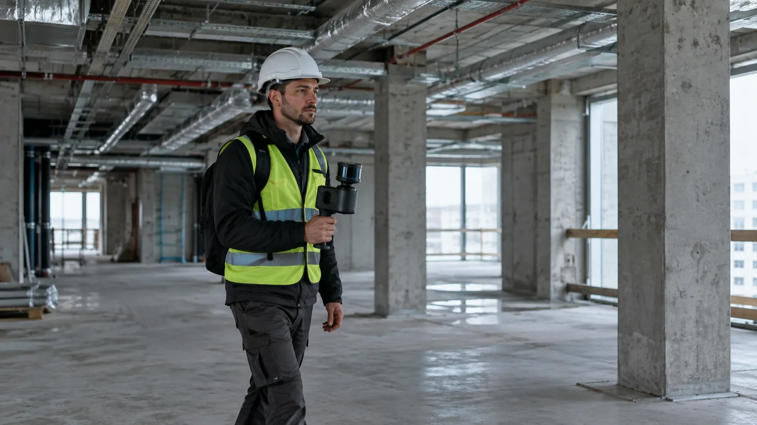
A tripod scanner captures each position quickly. Some survey-grade tripod scanners are advertised with a full-color scan in under two minutes. But a building needs many positions, and each one means setting up, scanning and moving the tripod. A handheld scanner captures while you walk.
One often-cited test shows the gap. According to Geo Week News in 2020, a UK general contractor compared both methods on a complex of buildings 57 meters wide. Two employees with tripod scanners and laser distance meters needed 32 field hours. One employee with a handheld LiDAR needed 4, which the article calls eight times faster. Treat that as one reported test on one site, in an article that also promotes a vendor webinar, not as a controlled study. Results depend on the building, the scanner and how clean the data must be. The direction fits how the two workflows differ, though: handheld capture removes the set-up and move steps between positions, and it needs fewer people on site.
Office time matters too. Tripod scans must be registered into one cloud, and modern systems automate much of that. Handheld SLAM registers continuously while you scan, and software such as SXMCA STUDIO handles processing and export.
Where Each Scanner Fits
Handheld SLAM scanners
- Building interiors, stairwells and tight rooms, where a tripod is slow.
- As-built updates and scan-to-BIM (building information modeling) for architecture, engineering and construction (AEC).
- Progress capture on active sites, where you cannot close areas for long.
- Factory floors and work cells for layout planning.
- Mapping the work areas of robots, or mounting the scanner on a drone or at a fixed position with the SXMCA2 HUB mounting unit.
Terrestrial laser scanners
- Survey control and georeferenced work where you need to defend millimeter accuracy.
- Facades and long exterior views.
- Plant and machinery detail, fit-up checks and monitoring over time.
Using both
A common workflow sets control points with a terrestrial scanner or an RTK survey, then fills in the site with a handheld scanner and registers it to that control. You get speed where tolerance is loose and precision where it is tight. For outdoor mapping, see our mapping and survey LiDAR solutions.
What Does CRATUS Offer in Handheld Scanners?
CRATUS carries some of the best price-performance tradeoff LiDAR scanners in the market. The three SXMCA models cover interior AEC and BIM work, construction and survey with built-in RTK, and dense long-range capture. Typical lead time is 2 to 3 weeks.
- SXMCA Lite: interior AEC and BIM work
- SXMCA2: construction, survey and mapping, with RTK built in
- SXMCA PRO: dense, long-range capture
- SX BAT spare battery: more scanning time per day
- SXMCA2 HUB mounting unit: stationary or drone mount
Battery runtime is listed as 110 minutes for the SXMCA Lite and 100 minutes or more for the SXMCA2. A spare SX BAT adds up to 150 minutes of scanning. Add software and training time to your plan, and compare the numbers for both scanner types on your own job before you decide.
How to Choose: Six Questions
- What tolerance does the job need? Centimeter work favors handheld. Millimeter work favors terrestrial.
- Where will you scan? Interiors and tight spaces favor handheld. Long exterior views favor terrestrial.
- How large is the site, and how often will you scan it? Frequent progress scans reward fast capture.
- Do scans need real-world coordinates? If yes outdoors, choose RTK. The SXMCA2 and SXMCA PRO have it built in.
- Who will scan and process? Handheld scanners have a shallower learning curve, so more of your team can use them.
- What software must the output open in? The SXMCA2 exports LAS, PLY, RCP and RCS. The SXMCA Lite exports LAS, PCD and PLY.
Which SXMCA Scanner Fits?
| Scanner | Best for | Key numbers (as listed on the product pages) |
|---|---|---|
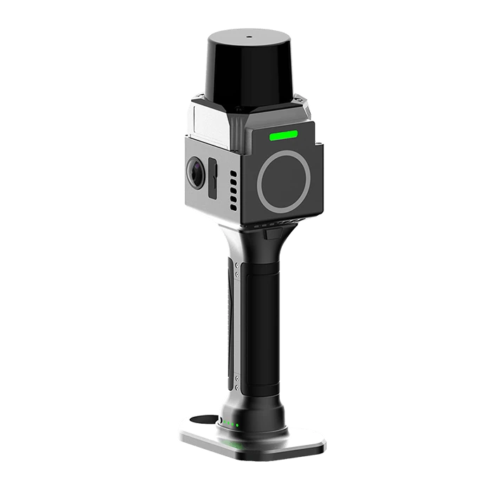
| SXMCA Lite | AEC and BIM work at short to mid range | Relative accuracy under 1 cm, 216,000 points/s, 1,125 g with battery |
| SXMCA2 | Construction, survey and mapping with RTK | Relative accuracy better than 1 cm, 200,000 points/s, 1,010 g with battery |
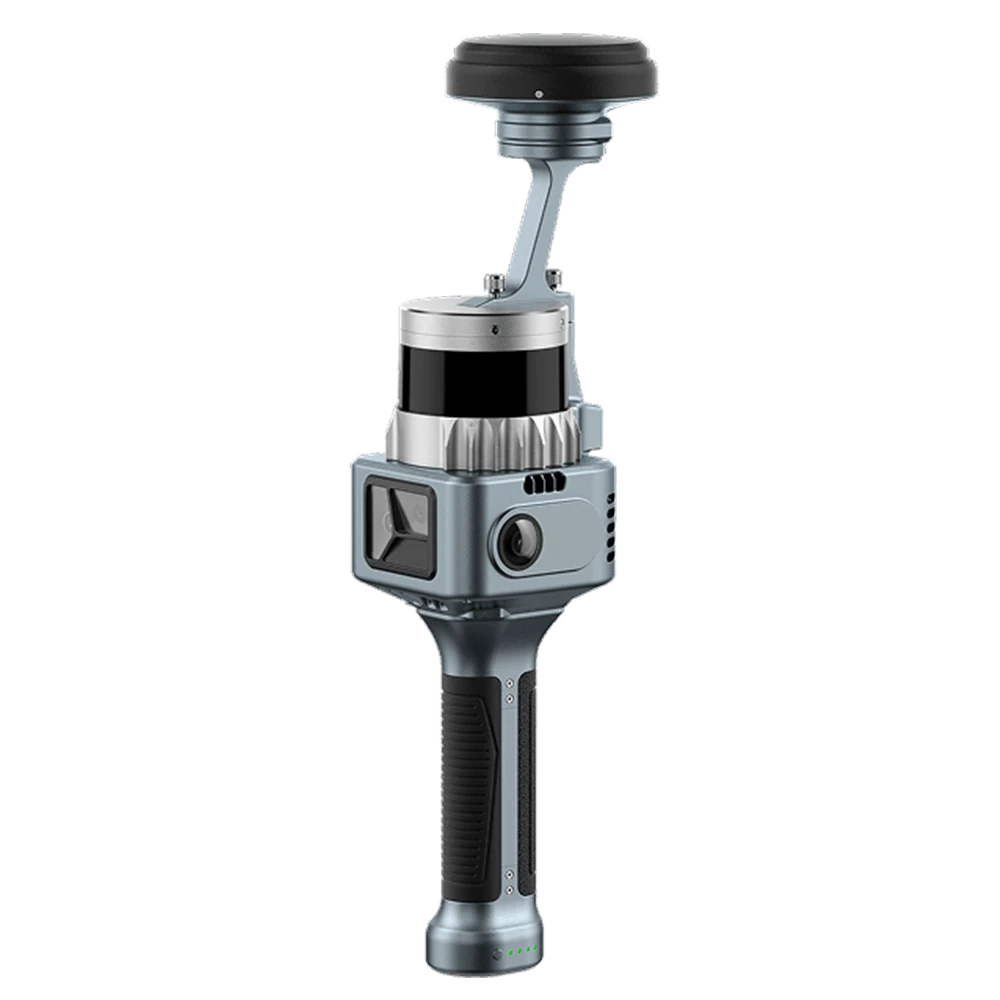
| SXMCA PRO | Dense, long-range capture | Up to 200 m range, up to 5.2 million points/s, about 5 mm precision |
Compare all three side by side on the handheld LiDAR scanners page, or ask for a quote.

Sources
- Geo Week News: Handheld and mobile scanning for AEC, 7 reasons (May 20, 2020)
- CRATUS handheld LiDAR scanners page, specifications as published on each product page
- Tripod scanner accuracy and timing figures come from published manufacturer datasheets and product pages, summarized in general terms
Last updated: November 18, 2026. Prepared by the CRATUS engineering team.
Frequently Asked Questions
Is a handheld LiDAR scanner as accurate as a tripod scanner?
No. Published datasheets of survey-grade tripod scanners list millimeter-class 3D point accuracy, about 2 mm at 10 m. Handheld SLAM scanners are centimeter class. For the SXMCA2, CRATUS lists relative accuracy better than 1 cm and absolute accuracy under 5 cm. For many as-built and interior jobs that is enough, if your specification allows centimeter tolerance. For millimeter tolerances it is not.
Can a handheld scanner replace a terrestrial scanner?
For many interior, as-built and progress-capture jobs, yes. For survey control, millimeter tolerances and long-range exterior work, no. Some teams use a terrestrial scanner or an RTK survey for control and a handheld scanner for fast coverage.
Does handheld SLAM work indoors without GPS?
Yes. SLAM software uses the LiDAR data and an inertial sensor to track how the scanner moves, so it works where satellite signals are weak. RTK is only needed outdoors, when scans must land in real-world coordinates.
Do I need RTK on a handheld scanner?
Only if your scans must be georeferenced outdoors without extra control points. The SXMCA2 and SXMCA PRO have RTK built in. The SXMCA Lite is aimed at interior AEC and BIM work.
How much training does a handheld scanner need?
Much less than a tripod workflow. Geo Week News lists minimal training as one reason handheld scanning suits construction, because scanning can be shared among available workers. Good habits still matter: walking pace, loop closure and control points.
Which handheld scanner should a small firm buy first?
Start from the job. If most work is building interiors and BIM, the SXMCA Lite is the entry point. If you also work outdoors and need coordinates, choose the SXMCA2 with RTK. If you need the longest range and densest clouds, ask about the SXMCA PRO.