
Auto-Grade 120° High-Resolution
Long-Range Lidar
$3,300.00
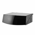


Auto-Grade 120° High-Resolution
Long-Range Lidar
Pixel Resolution
1200 x 128
Range
210 m @10% Reflectivity
Resolution
0.1° (H) × 0.2° (V)
Dimensions (W × D × H)
136 mm x 114 mm x 49 mm
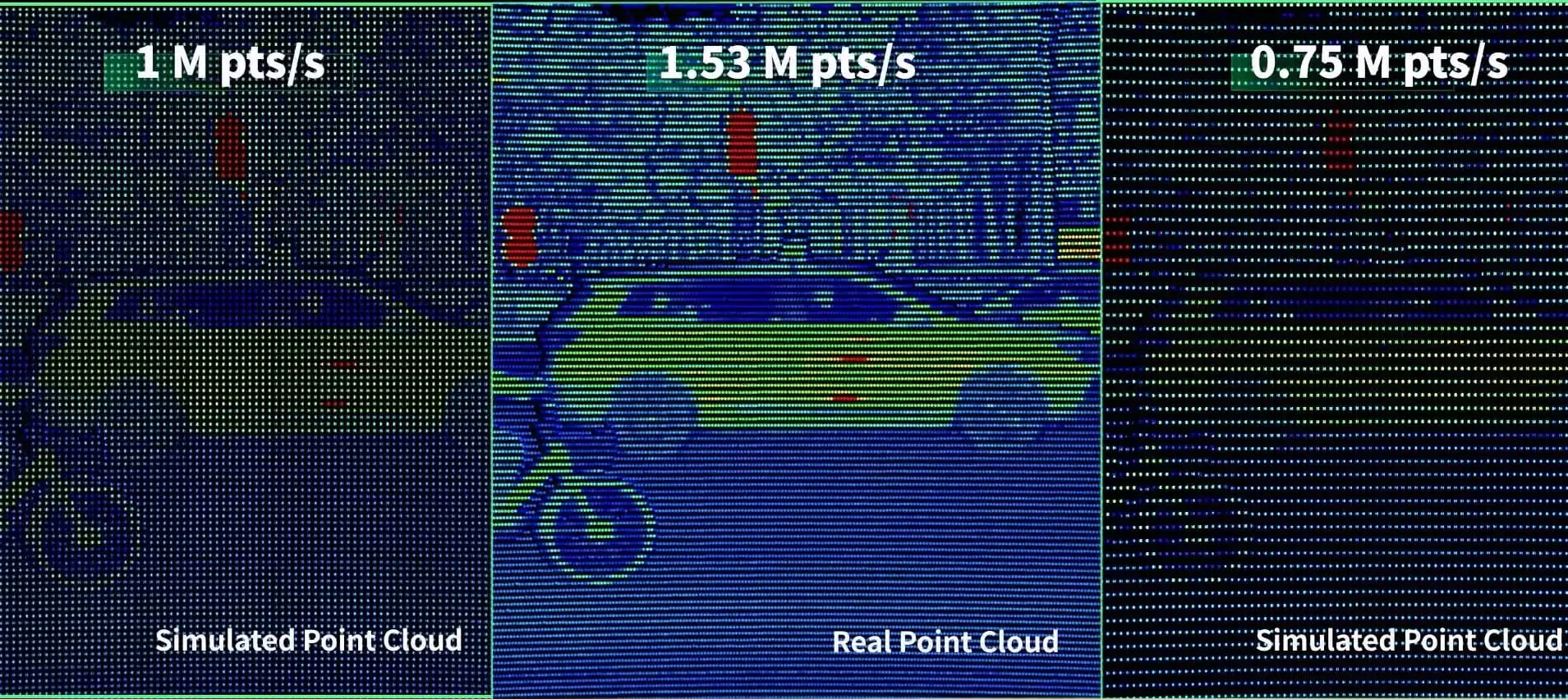
Point Rate
1,536,000 points/s
Field of View
120° × 25.4°
Power Consumption
13.5 W
Frame Rate
10Hz, 20Hz
HESAI AT128 0.1°×0.2°
Other lidars 0.2°×0.2°
All key components meet AEC-Q and other relevant standards.More than 50 design validation (DV) tests, conducted according to internationally recognized OEM standards such as electrical, mechanical, climatic, sealing, material, and EMC tests.
| JT16 | JT32 | JT64P | JT128 | FTX140/180 | FT120 | ATX | AT128 | AT360 | ETXP | XT16 | XT32 XT32M1X |
XT32M XT32m2X |
QT128 | OT128 | Pandar128 | |
|---|---|---|---|---|---|---|---|---|---|---|---|---|---|---|---|---|
| Object Detection | ● | ● | ● | ● | ● | ● | ● | ● | ● | ● | ● | ● | ● | ● | ● | ● |
| Mapping | ● | ● | ● | ● | ● | ● | ||||||||||
| Object Identification | ● | ● | ● | ● | ● | ● | ● | ● | ● | ● | ● | |||||
| Automotive Grade | ● | ● | ● | ● | ● | ● | ● | ● | ● | |||||||
| Channels | 16 | 32 | 64 | 128 | 192x256 | 120x160 | 256 | 128 | 360 | 1080/2160/4320 | 16/32 | 32 | 32 | 128 | 128 | 128 |
| Field of View | 360° X 40° | 360° X 40° | 360° X 189° | 360° X 99° | 140° X 105° / 180° X 140° | 100° X 75° | 140° x 20° | 120° X 25.4° | 18° X 120° | 120° × 20° | 360° X 31° | 360° X 31° | 360° X 40.3° | 360° X 105.2° | 360° X 40° | 360° x 40° |
| Range | 30m @ 10% Reflectivity | 30m @ 10% Reflectivity | 40m @ 10% Reflectivity | 20m @ 10% Reflectivity | 30m @ 10% Reflectivity | 22m @ 10% Reflectivity | 200 m @ 10% Reflectivity | 210m @ 10% Reflectivity | 250m | 300 m @ 10% Reflectivity | 80m @ 10% Reflectivity | 80m @ 10% Reflectivity | 80m @ 10% Reflectivity | 20m @ 10% Reflectivity | 200m @ 10% Reflectivity | 200 m @10% Reflectivity |
| Min Range | 0m | 0m | 0m | 0m | 0.1m | 1m | 0.05m | 0.05m | 0.5m | 0.05m | 0.3m | 0.3m | ||||
| Weight | 0.199kg | 0.199kg | 0.22kg | 0.22kg | 0.2kg | 0.7 kg | 0.36 kg | 0.94 kg | 950g | 0.6 kg | 0.8 kg | 0.8kg | 0.49 kg | 0.7 kg | 2.2 kg | 1.63 kg |
| Accuracy | 3cm | 5 cm | 5 cm | 5 cm | 5cm | 1 cm | 1cm | 1 cm | 3 cm | 3 cm | 5cm | |||||
| Max Range | 100m | 100m | 25m | 25m | 50m | 300m | 260m | 300m | 120m | 120m | 300m | 50m | 230m | 200m | ||
| Resolution Horizontal | 0.6° | 0.6° | 0.4° | 0.45° | 0.56° | 0.625° | 0.08° | 0.1° - 0.2° | 0.06° - 0.12° | 0.06° | 0.09° - 0.36° | 0.09° - 0.36° | 0.09° - 0.36° | 0.4° - 1.6° | 0.1° - 0.4° | 0.1° |
| Resolution Vertical | 2.67° | 1.29° | 1.5° | 0.8° | 0.56° | 0.625° | 0.1° | 0.2° - 0.8° | 0.05° - 0.1° | 0.055° | 1°/ 2° | 1° | 1.3° | 0.4° - 1.6° | 0.125° - 1.72° | 0.125° |
| Availability | Phasing Out | Taking Orders | Taking Orders | Now | Sampling Now. Production June 2026 | Phasing Out | Now | Now | Now | Sampling Now. Production 2027 | Now | Now | Now | Now | Now | Phasing Out |
The HESAI AT128 is an automotive grade long range LiDAR designed for ADAS and autonomous driving applications. It is built as a high resolution main LiDAR sensor for vehicles that need long distance 3D perception, object detection, and real time driving environment awareness.
HESAI AT128 is suitable for ADAS vehicles because it combines 128 channels, 1,536,000 points per second, 120° x 25.4° field of view, and 210 m detection at 10 percent reflectivity. These specifications help vehicles detect cars, pedestrians, and road objects at long distances.
Yes. The HESAI AT128 is positioned as a long range automotive LiDAR with 210 m ranging capability at 10 percent reflectivity. This makes it relevant for forward perception in ADAS systems where early object detection is important for highway driving and autonomous mobility.
The HESAI AT128 has 128 channels and a 1200 x 128 pixel resolution, allowing it to capture high density point cloud data. Higher resolution helps the vehicle recognize object shape, distance, and position more clearly than lower density sensors.
The 1.53 million points per second rate matters because it gives the AT128 dense real time 3D perception. For ADAS and autonomous driving, higher point density can improve the visibility of vehicles, pedestrians, lane edge objects, and other road users at speed.
The HESAI AT128 has a 120° x 25.4° field of view. This wide forward sensing area is designed for vehicle integration, helping cover the road ahead without requiring a stitched multi sensor view for the main front perception zone.
Yes. The HESAI AT128 is designed for automotive grade and mass produced ADAS programs. It has been nominated by multiple ADAS programs from top OEMs and is positioned as an automotive grade, mass production LiDAR solution.
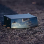
The HESAI AT128 is designed for small form factor vehicle integration, with listed dimensions of 136 mm x 114 mm x 49 mm and a weight of 940 g. This helps vehicle designers integrate a long range LiDAR into front fascia, roofline, or other automotive sensor placements.
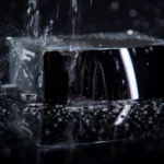
Yes. The AT128 is designed for ADAS, automotive grade, and mass production use, with key components meeting AEC-Q and other relevant standards. It has undergone more than 50 design validation tests covering electrical, mechanical, climatic, sealing, material, and EMC requirements.
A team should choose HESAI AT128 when it needs an automotive grade long range main LiDAR for ADAS, forward object detection, high resolution 3D perception, and production vehicle integration. It is especially relevant when 210 m range, 128 channels, 1.53 million points per second, and compact automotive packaging are key requirements.
CONTACT US / BUY
One of our experts will be communicating with you shortly. We are committed to understanding your application and providing support, tailored to your specific requirements.
Receive Quote
One of our experts will be communicating with you shortly. We are committed to understanding your application and providing support, tailored to your specific requirements.