

HESAI XT32M2X Long Range High Accuracy Drone Mapping Autonomous Driving Lidar Sensor
32-Channel 360° Spinning Mid-Range Lidar
High Precision. Minimum Range of Zero. Cost Efficient
$8,750.00
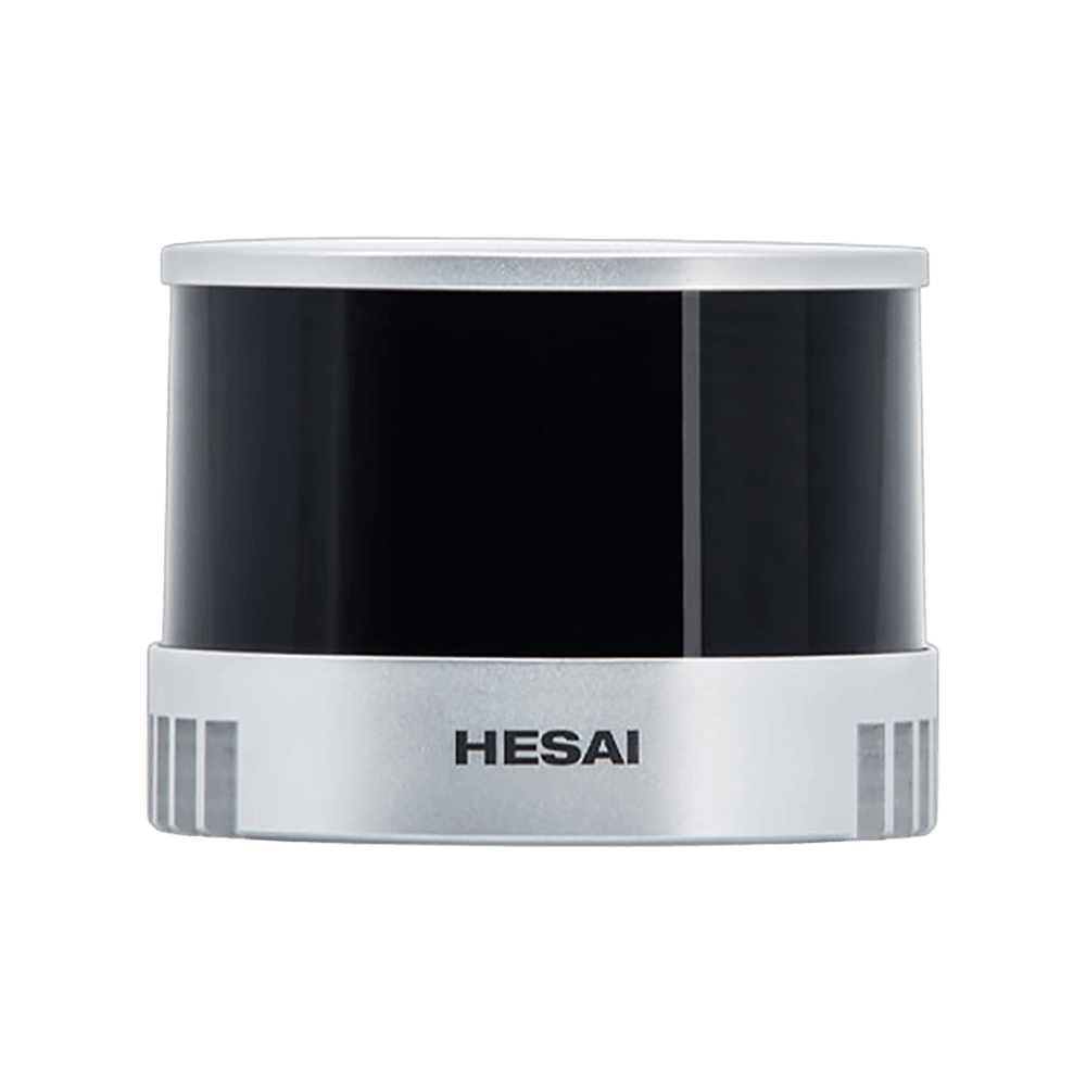
Minimum Range of Zero
Objects can be effectively detected even if directly touching the sensor’s enclosure; blind range of zero.
Mid-Range Lidar
HESAI XT32M
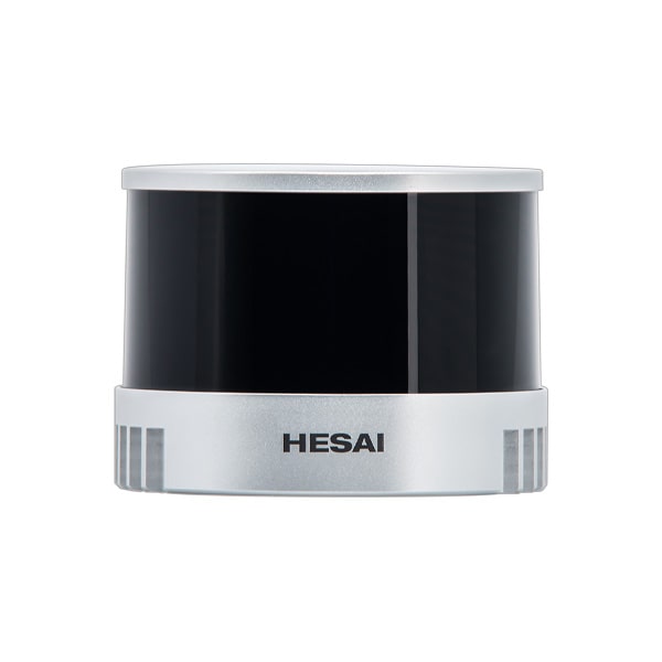
*The appearance of products published on this website may vary due to screen display settings, production batches, and customization. Please refer to the actual sample/product; The product specifications shown on this website are typical values under specific test conditions and may slightly vary due to production batches, firmware and hardware versions, as well as application conditions. Please refer to final factory inspection. For product certification information, please refer to official certifications. Hesai reserves the right of final interpretation of the information on this website. *Please read the relevant safety precautions before using the product.
SPECIFICATION DETAILS
Ranging Capability
0.5 ~ 300 m
Range Precision
0.5 cm 1σ
Accuracy
±1 cm
Point Rate
640,000 [Single Return]
Field of View
360° x 40.3°
Angular Resolution
0.18° (H) x 1.3° (V)
Dimensions
Φ 75 x H 93 mm
Weight
490 g
RELIABILITY VALIDATION
UV Aging
High-Temperature
IP6K7 & IP6K9K
Mechanical Shock
Salt Spray
Thermal Shock with Water Splash
Low-Temperature Wakeup
Humid Heat Cyclic
Vibration with Thermal Cycling
Electrical & Electronic Test
CERTIFICATIONS
- Class 1 Eye Safety
Higher Resolution, Further Range
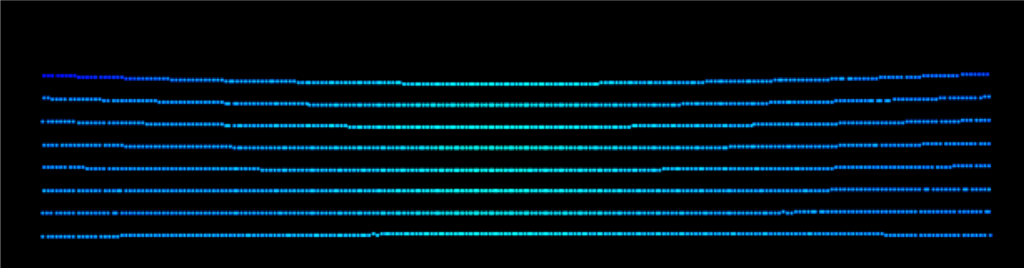
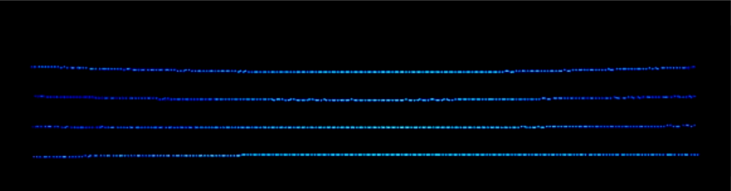
Double the resolution and number of lasers compared with typical mid-range lidars (16 channels).
Range detection up to 120m, POD>90% when detecting 10% reflectivity targets at 80 m.
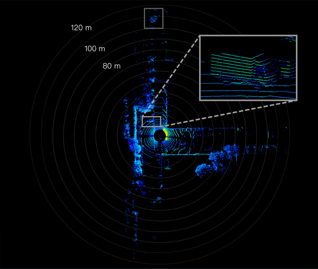
XT32
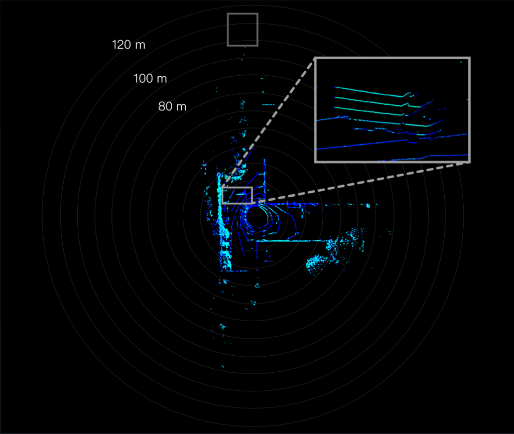
Typical 16-channel lidar
High Precision
XT32
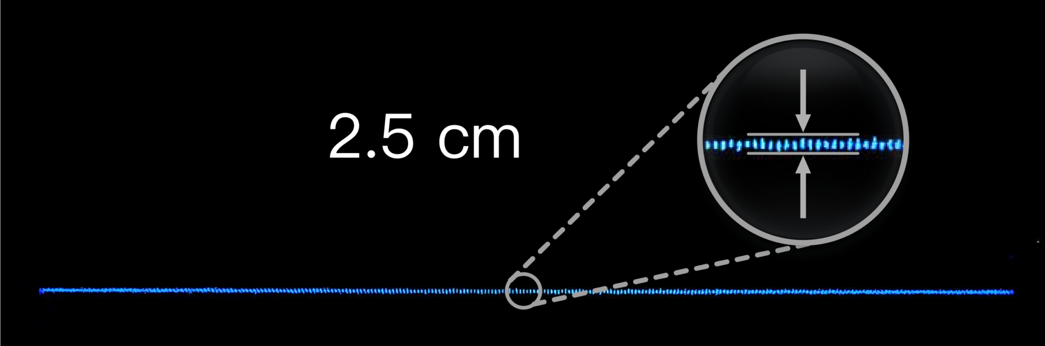
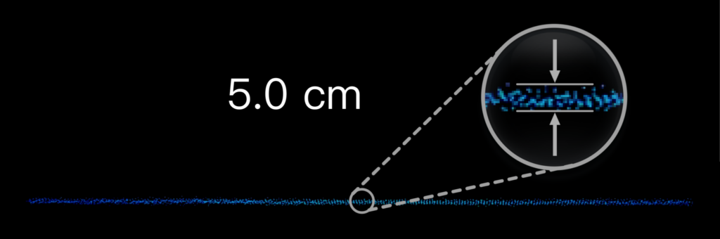
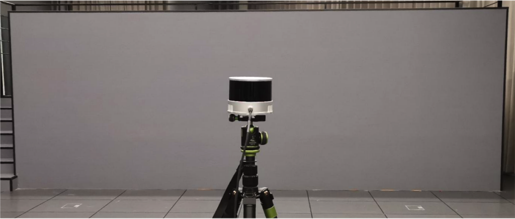
The thickness of a wall at 6 m scanned by XT32 is approximately half of the generic lidar's. Peak-to-peak thickness is 2.5cm; corresponding precision (1σ) is ~0.5 cm.
Typical 16-channel lidar
High-Quality Reflectivity Information
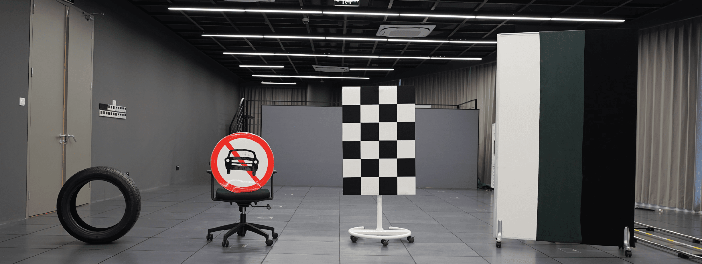
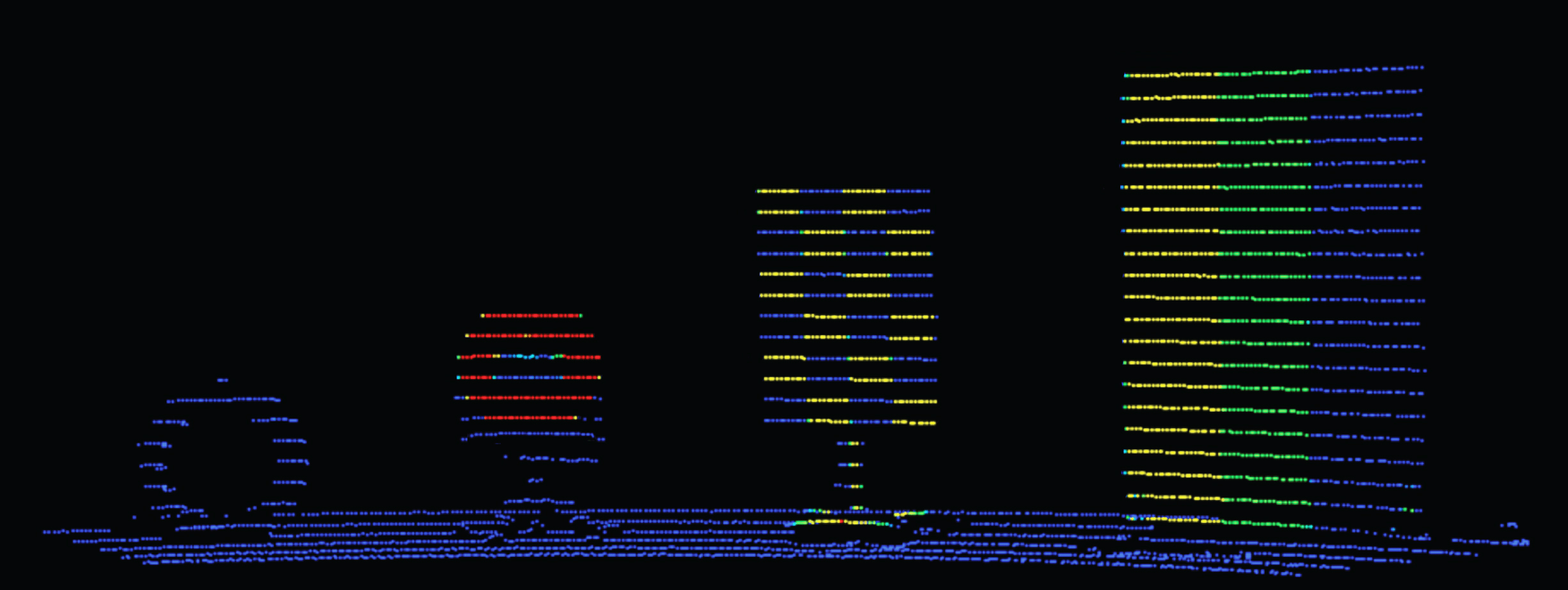
XT32 offers more accurate reflectivity information.
HESAI Lidar Sensor Selection Guide
| JT16 | JT32 | JT64P | JT128 | FTX140/180 | FT120 | ATX | AT128 | AT360 | ETXP | XT16 | XT32 XT32M1X |
XT32M XT32m2X |
QT128 | OT128 | Pandar128 | |
|---|---|---|---|---|---|---|---|---|---|---|---|---|---|---|---|---|
| Object Detection | ● | ● | ● | ● | ● | ● | ● | ● | ● | ● | ● | ● | ● | ● | ● | ● |
| Mapping | ● | ● | ● | ● | ● | ● | ||||||||||
| Object Identification | ● | ● | ● | ● | ● | ● | ● | ● | ● | ● | ● | |||||
| Automotive Grade | ● | ● | ● | ● | ● | ● | ● | ● | ● | |||||||
| Channels | 16 | 32 | 64 | 128 | 192x256 | 120x160 | 256 | 128 | 360 | 1080/2160/4320 | 16/32 | 32 | 32 | 128 | 128 | 128 |
| Field of View | 360° X 40° | 360° X 40° | 360° X 189° | 360° X 99° | 140° X 105° / 180° X 140° | 100° X 75° | 140° x 20° | 120° X 25.4° | 18° X 120° | 120° × 20° | 360° X 31° | 360° X 31° | 360° X 40.3° | 360° X 105.2° | 360° X 40° | 360° x 40° |
| Range | 30m @ 10% Reflectivity | 30m @ 10% Reflectivity | 40m @ 10% Reflectivity | 20m @ 10% Reflectivity | 30m @ 10% Reflectivity | 22m @ 10% Reflectivity | 200 m @ 10% Reflectivity | 210m @ 10% Reflectivity | 250m | 300 m @ 10% Reflectivity | 80m @ 10% Reflectivity | 80m @ 10% Reflectivity | 80m @ 10% Reflectivity | 20m @ 10% Reflectivity | 200m @ 10% Reflectivity | 200 m @10% Reflectivity |
| Min Range | 0m | 0m | 0m | 0m | 0.1m | 1m | 0.05m | 0.05m | 0.5m | 0.05m | 0.3m | 0.3m | ||||
| Weight | 0.199kg | 0.199kg | 0.22kg | 0.22kg | 0.2kg | 0.7 kg | 0.36 kg | 0.94 kg | 950g | 0.6 kg | 0.8 kg | 0.8kg | 0.49 kg | 0.7 kg | 2.2 kg | 1.63 kg |
| Accuracy | 3cm | 5 cm | 5 cm | 5 cm | 5cm | 1 cm | 1cm | 1 cm | 3 cm | 3 cm | 5cm | |||||
| Max Range | 100m | 100m | 25m | 25m | 50m | 300m | 260m | 300m | 120m | 120m | 300m | 50m | 230m | 200m | ||
| Resolution Horizontal | 0.6° | 0.6° | 0.4° | 0.45° | 0.56° | 0.625° | 0.08° | 0.1° - 0.2° | 0.06° - 0.12° | 0.06° | 0.09° - 0.36° | 0.09° - 0.36° | 0.09° - 0.36° | 0.4° - 1.6° | 0.1° - 0.4° | 0.1° |
| Resolution Vertical | 2.67° | 1.29° | 1.5° | 0.8° | 0.56° | 0.625° | 0.1° | 0.2° - 0.8° | 0.05° - 0.1° | 0.055° | 1°/ 2° | 1° | 1.3° | 0.4° - 1.6° | 0.125° - 1.72° | 0.125° |
| Availability | Phasing Out | Taking Orders | Taking Orders | Now | Sampling Now. Production June 2026 | Phasing Out | Now | Now | Now | Sampling Now. Production 2027 | Now | Now | Now | Now | Now | Phasing Out |
Frequently Asked Questions
What is the HESAI XT32M2X LiDAR used for?
The HESAI XT32M2X is a 32 channel 360° spinning mid range LiDAR designed for drone mapping, autonomous driving, spatial sensing, stationary applications, warehousing, logistics, service robotics, and professional reality capture workflows. Its main value is high precision 3D scanning with long range coverage in a compact sensor body.
Is it suitable for drone mapping?
Yes. It combines 360° scanning, 0.5 to 300 m ranging capability, 0.5 cm range precision, ±1 cm accuracy, and a 490 g sensor weight — relevant for aerial surveying, terrain mapping, vegetation analysis, and professional 3D data capture.
Why is it useful for scan to BIM and reality capture?
It delivers high precision 3D point cloud data with 32 laser channels and strong range performance, supporting professional reality capture workflows such as mobile mapping, digital factory modeling, AEC projects, and scan to BIM applications.
What is the detection range of the HESAI XT32M2X?
Ranging capability is approximately 0.5 m to 300 m, with strong detection performance at around 80 m for low reflectivity targets — suitable for long range mapping and spatial sensing applications.
How accurate is it?
Listed figures are 0.5 cm range precision and ±1 cm accuracy — suitable where clean geometry, reliable point cloud thickness, and accurate 3D reconstruction matter, such as mapping, inspection, and digital twin capture.
What is the field of view?
The field of view is 360° x 40.3°, capturing a full horizontal scene while maintaining vertical coverage for 3D mapping, mobile scanning, and spatial sensing applications.
Why does reflectivity quality matter?
LiDAR does not only measure distance — it also helps interpret surface characteristics. High quality reflectivity data across surfaces with different reflectance values supports better understanding of objects such as tires, traffic signs, and structured materials.
Is it better suited for mapping or obstacle detection?
It is especially strong for mapping, reality capture, spatial sensing, and digital twin workflows, while also supporting object detection in applications such as drone mapping, service robotics, warehousing, logistics, and stationary sensing.
Is it reliable for industrial environments?
Validation covers UV aging, high temperature, IP6K7 and IP6K9K protection, mechanical shock, salt spray, thermal shock with water splash, low temperature wakeup, humid heat cycling, vibration with thermal cycling, and electrical and electronic testing.
When should a team choose the HESAI XT32M2X?
Choose the XT32M2X when you need a compact 32 channel 360° LiDAR for high precision mapping, drone based surveying, scan to BIM, reality capture, digital twin generation, or long range spatial sensing — most relevant when range, precision, reflectivity quality, and full scene 3D capture are more important than only short range collision avoidance.